
We’re big fans of the home brewed Tactical NAV app and its creator Jonathon Springer so we’re quite pleased to bring you some news. If anyone has ever earned the title TacHacker, it’s this guy.
First off, the makers of Tactical NAV recently released “Compass NAV” for Android a couple of weeks ago. Basically it’s just the compass function of TACNAV and it’s priced at .99 cents.

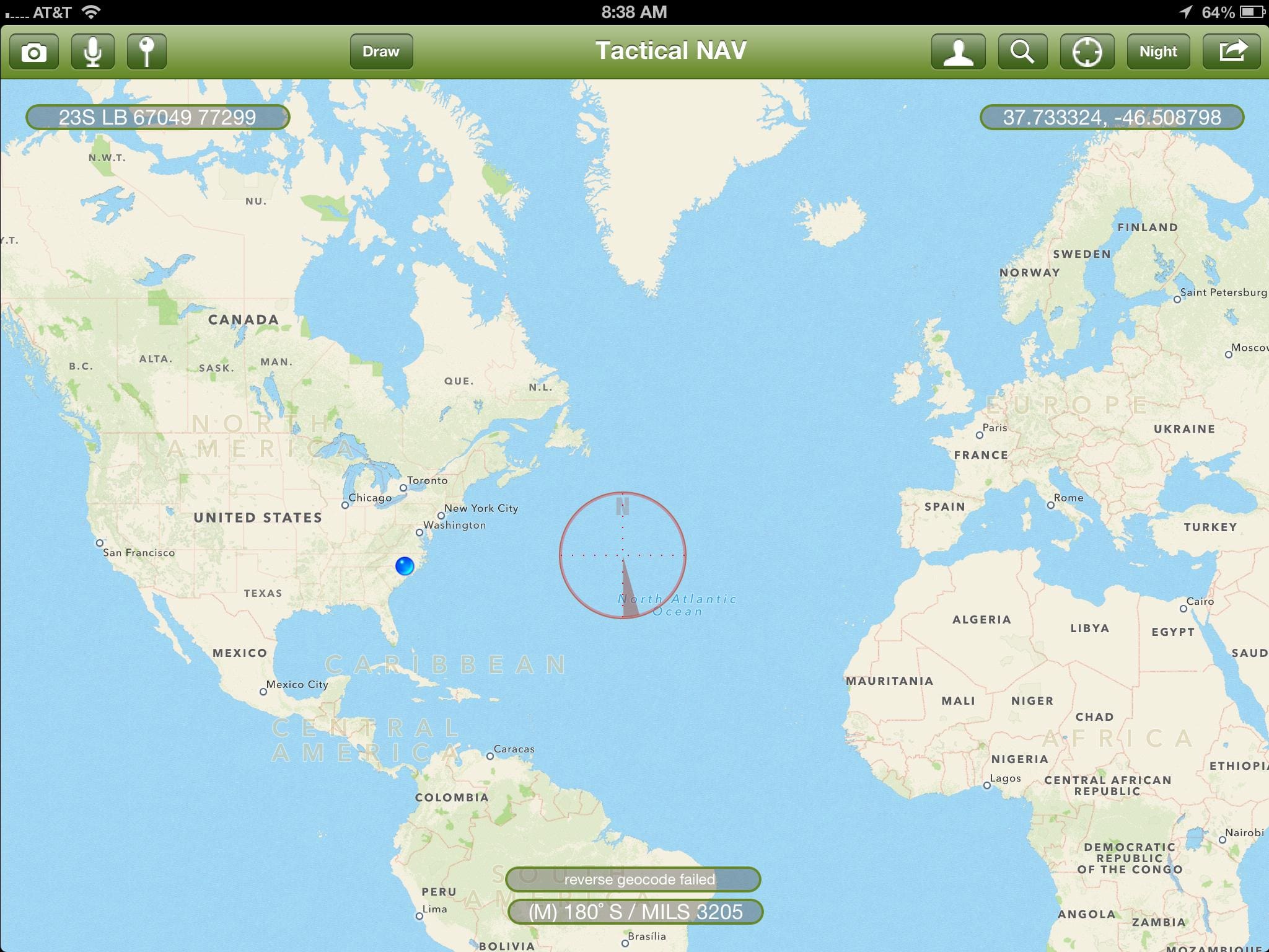
Tactical NAV is also in the midst of an update that will include –
– Separate iPad and Android versions … plus a new iPhone version (free update for existing users)
– Troop tracking (all users on all systems — iPhone, iPad, Android will be able to see each other on the battlefield along with MMS/SMS messaging capabilities between each other, etc)
– A realtime “FreeDraw” – a sandtable-like capability that will act very similar to BFT and CPOF
– iCloud integration
– Facebook integration
– Ability to record video with geolocation-data updated in realtime for playback later
– Voice annotating function
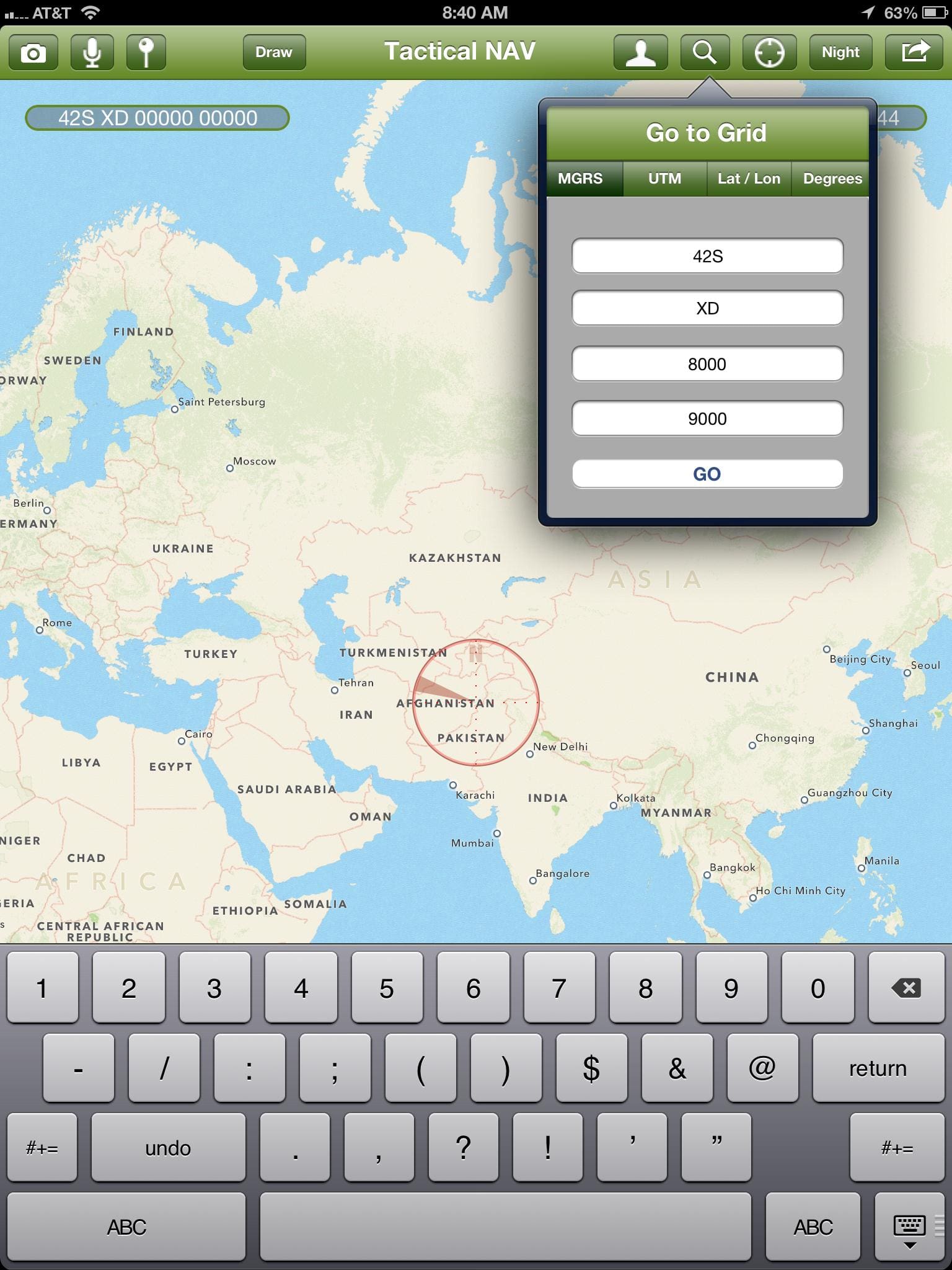
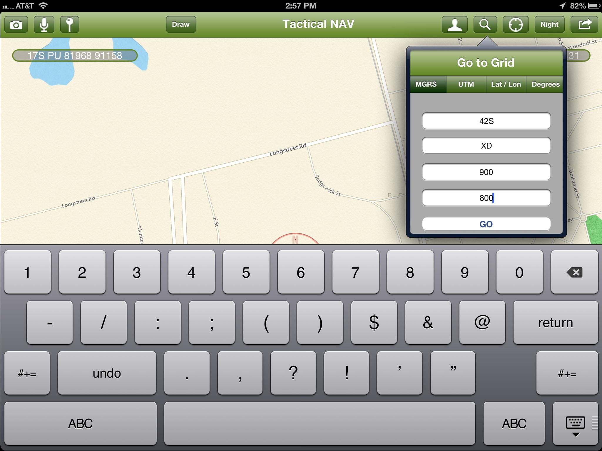
– UTM addition
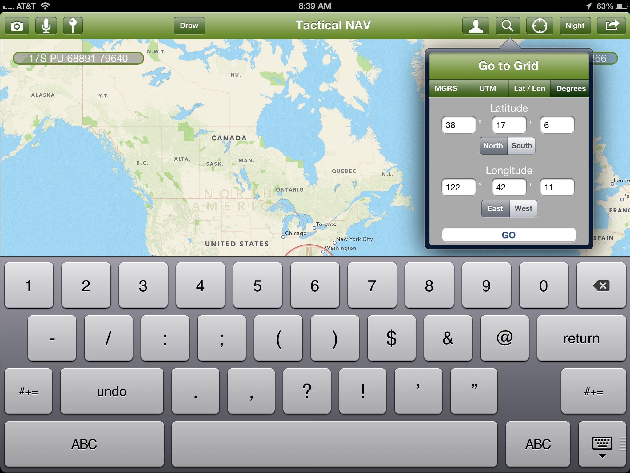
– “Go to Grid” will be able to work with MGRS, LAT/LONG, and UTM
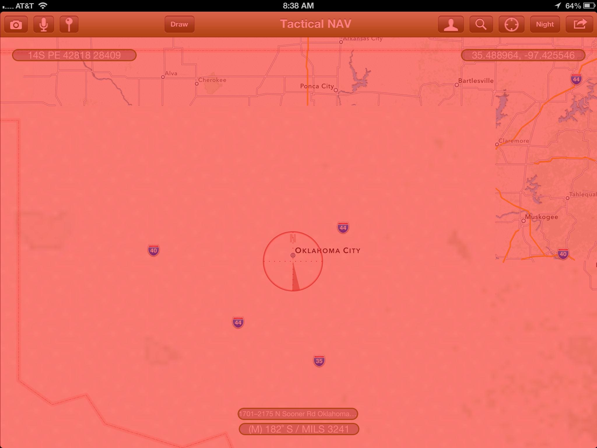
Here are some screenshots of Tactical NAV running on iPad.

‘Like’ them on Facebook at www.facebook.com/tacticalnav.
Tags: Android, iPad, iPhone, Tactical NAV
This is a nice app, but I wonder what sort of opsec issues have already been encountered due to all of this happening on unclassified networks. Add more functionality and there will be more opportunities for sensitive info being posted where it shouldn’t.
Any idea if these apps are getting scooped up for integration in secure systems?
it seems like one should only be putting work-related data into work-issued/allowed devices operating on work networks. I wouldn’t put this on your iphone that you use for everything else…
Fair enough. Necessity is the mother of invention. Other than a couple of hobby shop science projects within DoD, the capability doesn’t exist. And I realize that the folks running those science projects will get upset when they read this but tough shit. For them I say, “While you spin your wheels discussing requirements and toying with yesterday’s technology, guys like Springer are making things happen.”
Note that my comment was directed at Warfighter and not Admin or the creator of this app. I think this app is awesome and I want one for my android phone like yesterday, but people need to realize that this type of software is necessary and as you said this is the only way to get the ball rolling. I was just saying that people who know what they’re doing will use this on two separate devices and not mix work and play on their personal iPhones.
bought.
can we get an android version of the full program?
@mike
Sir,
Coming very soon — tweaking the code now.
God Bless,
Jonathan
I hope we’ll see the update on Soldier Systems when that happens, because I will immediately buy it and I never buy (out of principle, free solutions for most things) apps on my phone.
[begin tactical desk jockey opinion]
From the website
“Tactical NAV was COMBAT tested
Soldiers will appreciate how Tactical NAV can help in the field. Map, plot and photograph navigational points, find your way back to an observation post, employ the night mode function for easier viewing in the dark, switch between different types of data and take advantage of Camera mode, with data displayed in real-time and photo stamping ability.
…. Map & plot navigational waypoints, share location and waypoint information with other Tactical NAV users by email, and even take photographs stamped with GPS coordinates. These are just some of the tools the U.S. Military and NATO Armed Forces use to conduct combat operations on a daily basis – and now, these tools are available to YOU in Tactical NAV.”
What?! I happen to know there is no private / classified cell network in afghan, in fact one of the largest networks (in 09-10 while I was there) had a pakistani majority shareholder and most towers were assembled in pak. Another provider was from EAU with large share holders in saudi.
So Capt Jonathan J. Springer was gps stamping fire points and sending them to others via unsecured network.. oh, and troop movement information at a granular way-point level. I’m sorry, his command failed in enforcing opsec policy; on a rather grand scale.
my 2 cents … as someone who handled spillages a number of times a week, and now wishes there were more information assurance visibility into the public networks… sigh.. lessons learned..
So rather than be an apparatchik what have you done to facilitate our war fighting capability? It’s easy to blindly enforce rules, quite another to work with the warfighter and make things happen. Having spent 21 years within DoD and another couple of years after retirement I have come to the conclusion that we are our own worst enemy.
When a guy doesn’t have the tools he needs to do his job, he is going to make his own and guys who can’t even do the job are going to do their damnedest to crucify him for it. It’s the way this business works. So are you going to be part of the solution or part of the problem? The problem isn’t that someone may or may not have used a non-DoD network. The problem is that he may have had to.
@SSD
Sir,
Thanks for the support by fire — couldn’t have responded better if I wanted to.
God Bless,
Jonathan
The goal was always try and keep the warfighter moving. Some situations require violation of opsec, I was made aware of a situation where yahoo messenger and mobile phones were used to call for fire. It was a life threatening situation, to hell with opsec. I wouldn’t go so far as to say all call for fires should be made the same way.
CPT, forgive the post if it seemed overly critical, looks like a great product, based off a need in the field. I commend you on taking the initiative and investing your own time and money into the product.
That said, device forensics is a field the whole world in interested in, not just the US. The data mined from a brick phone Nokia can be very very ‘actionable’. The data pulled off an Iphone running something like this…. who knows.
And I love it, I’m a coms geek, off the shelf is awesome, it can be in the field tomorrow. I would like to see end to end encryption, all data on the device and all data leaving device. I would say it’s vital for devices carrying data and transmitting data about troop movements, but it’s not my job anymore to enforce or make policy about such things. I don’t know what you used it for, so really can’t make a judgment call. Again, I apologize if my post came off judgmental. I’m very glad it worked for you.
@swiss
Sir,
No sweat — after seeing some of our Soldiers killed/wounded in action there in the Pech Valley, I just felt I needed to do something for them — and others — as a leader on the battlefield.
My only goal with this project is to possibly save troopers’ lives, and that’s it. Hopefully it’s worked in some capacity.
I’ve reached out to the Army for assistance, but have recieved none. So, I continue mission with my small coding team in hopes of helping others ‘fighting the fight’.
Bottom line, no apologies needed. What I will say, though, is that there is encryption built into the app, but I won’t go into further details for obvious reasons.
Have a Blessed day and take care.
Respectfully,
Jonathan
Just downloaded the app for the iPhone. No troop tracking or sand table feature. Dissapointed to say the least
That’s with the new version they are working on.