
Finally, a rival to the PowerPoint Ranger. Meet, MDMP Ninja.
Actually, Tacteris has developed a collaborative mission planning software called Maestro.
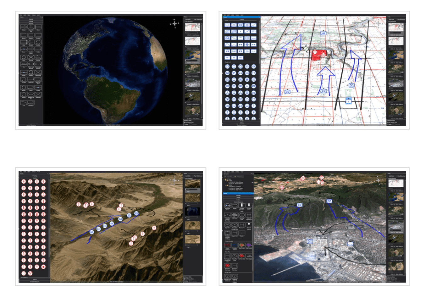
Features:
-3D map view
-Easy-to-learn drag & drop interface
-Over 1000 military symbols (MIL-STD 2525/APP-6)
Mission/task symbology
-Control measures for a wide variety of sub-plans (ISTAR, Indirect Fire, Engineering, etc.)
-Over 100 standard map formats including GeoTIFF
-Common terrain elevation models
-Coordinate formats: MGRS, UTM, Lat/Long
-Standalone application (no servers/networks required)
-ITAR Free (Product of Canada)
Tags: Tacteris
Just what we need, another digital planning suite to add to our toolbox that doesn’t fully connect to C2PC, BFT, GCSS, TCPT, CPOF, Google Earth, or Palantir.
You left out Falconview, ARCGIS, and some others… though this looks like a simplified version of what FView accomplishes.
Jon, OPT
It’s ITAR free.
These go to 11…
Ah Falconview. Don’t worry, all the bugs will be fixed when XPlan comes out! Replacing Falconview in 2011! …..wait.
I was hearing that promise in the 90s when the plan was JMPS.
ITAR-free? So it definitely doesn’t sound like it’ll work with the existing software suites. MDMP is a pain in the ass, but I don’t see how adding more software to the equation will solve anything? It’s not like people know how to execute MDMP anyway…
Yes, ITAR Free. If it’s something you worry about, then it’s an issue.
When I was a Bn S2, I would have killed for something like that, especially as a Guard guy. Wouldn’t care about interoperability when I just need my products done yesterday.
This software needs to include the following disclaimers:
*Facilitates the planning process only – does not replace it entirely
*Will not reduce the amount of information echelons above your formation feel they need to have in our “mission command” environment
*Despite creating the worlds greatest CONOP products, higher HQ will always change their mind immediately before missions and require you to produce the same amount detailed plan in a fraction of the time for something entirely unanticipated