SureFire

Posts Tagged ‘Tactical NAV’

TacApps – Tactical NAV News

Wednesday, August 8th, 2012

We’re big fans of the home brewed Tactical NAV app and its creator Jonathon Springer so we’re quite pleased to bring you some news. If anyone has ever earned the title TacHacker, it’s this guy.

First off, the makers of Tactical NAV recently released “Compass NAV” for Android a couple of weeks ago. Basically it’s just the compass function of TACNAV and it’s priced at .99 cents.

Tactical NAV is also in the midst of an update that will include –

– Separate iPad and Android versions … plus a new iPhone version (free update for existing users)
– Troop tracking (all users on all systems — iPhone, iPad, Android will be able to see each other on the battlefield along with MMS/SMS messaging capabilities between each other, etc)
– A realtime “FreeDraw” – a sandtable-like capability that will act very similar to BFT and CPOF
– iCloud integration
– Facebook integration
– Ability to record video with geolocation-data updated in realtime for playback later
– Voice annotating function
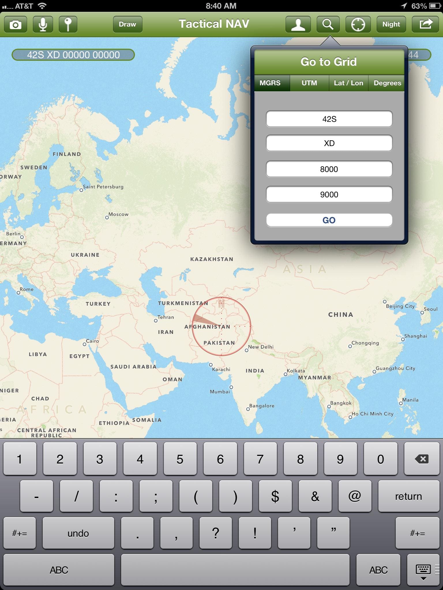
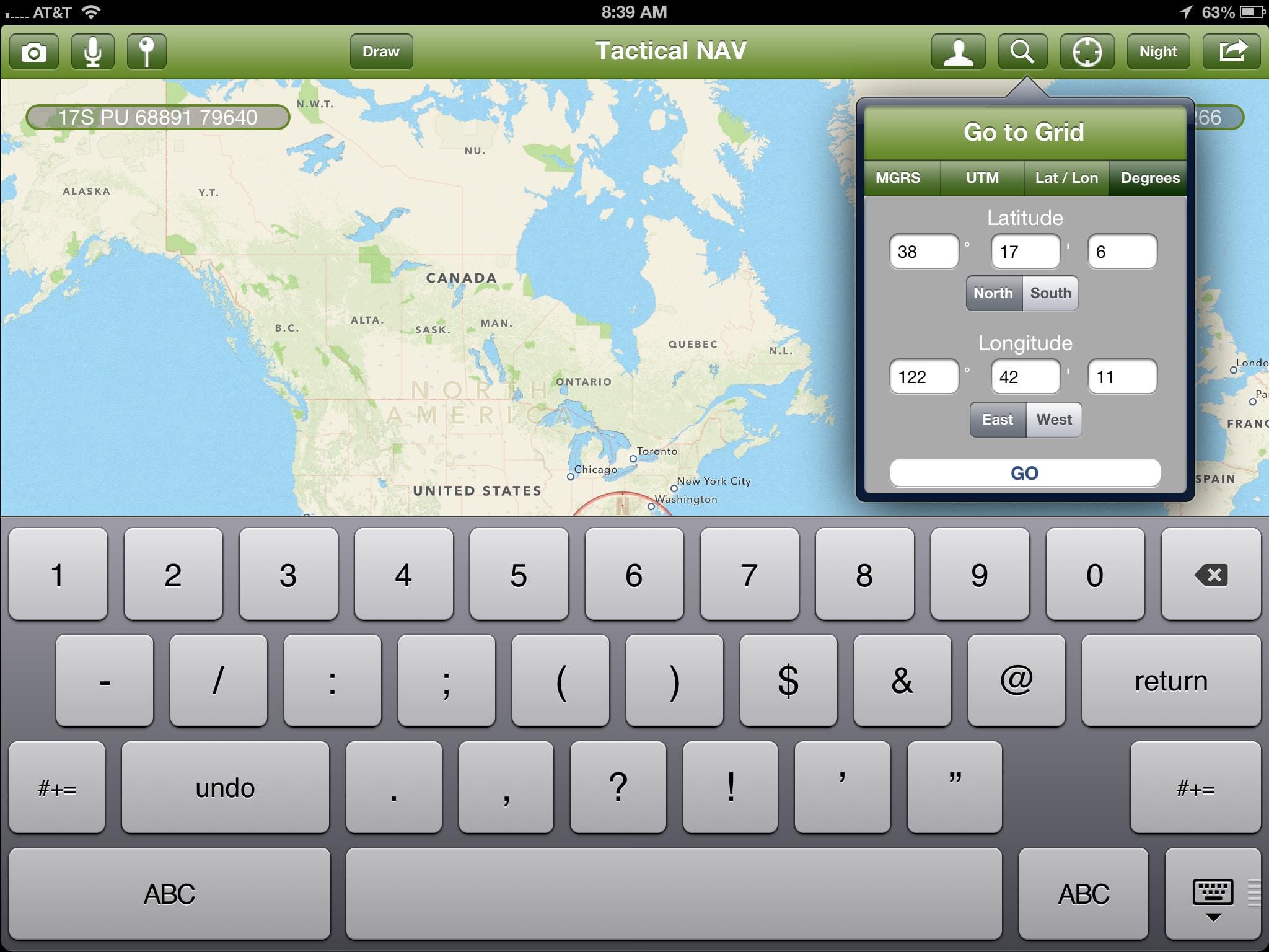
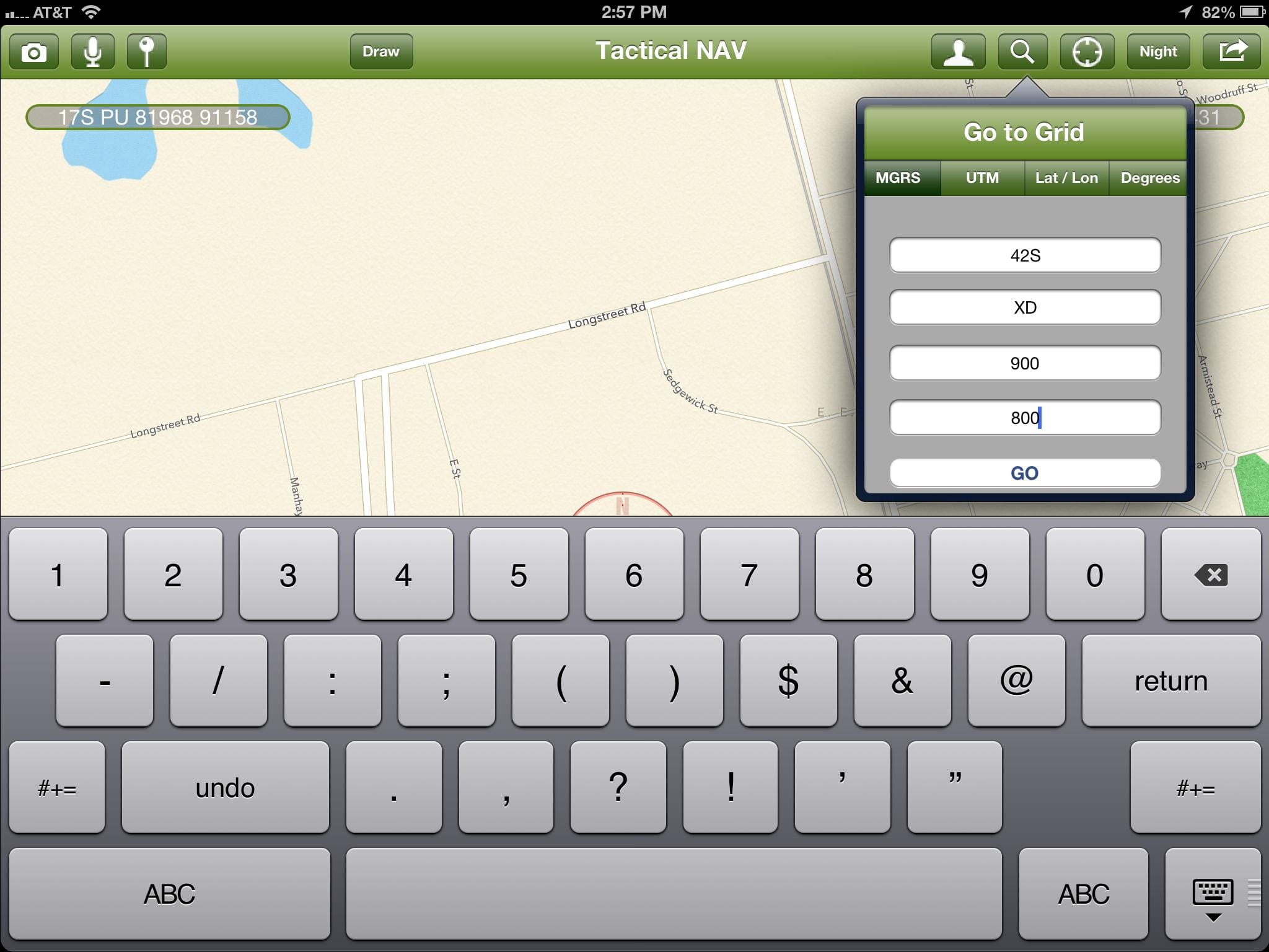
– UTM addition
– “Go to Grid” will be able to work with MGRS, LAT/LONG, and UTM

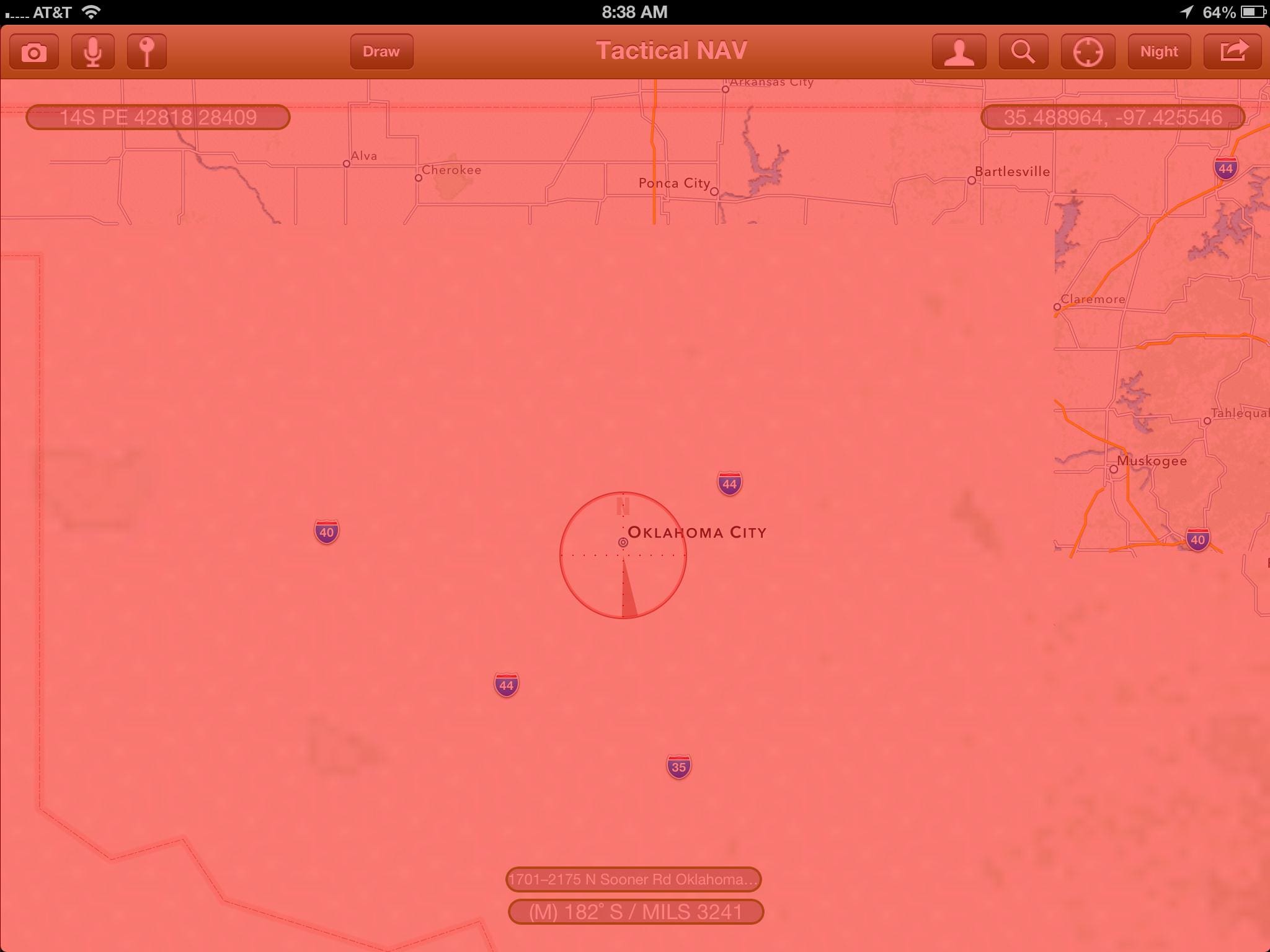
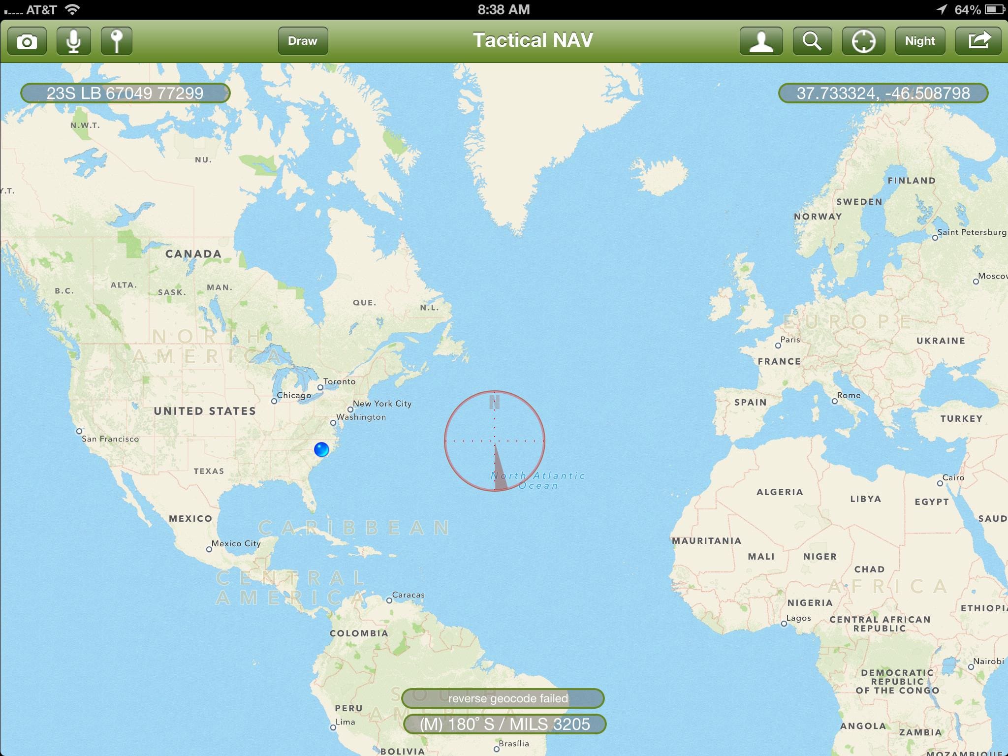
Here are some screenshots of Tactical NAV running on iPad.

‘Like’ them on Facebook at www.facebook.com/tacticalnav.

www.tacticalnav.com

Tactical NAV 2.5 Just Released

Monday, October 3rd, 2011

Rev 2.5 of the popular Tactical NAV app was recently released with increased GPS accuracy as well as the ability to turn the crosshairs off. Once iOS 5 hits, there will be another minor update.

Additionally, the brains behind the app, Army CPT Jonathan Springer informed us that he has begun to work on an Android version of the software which will include all of the functionality of the iOS app. Development will take 60-90 days due to the complexity of the code. This is huge news considering that the Army is investigating the Android platform as their answer to the Nett Warrior program. Unfortunately, the Army won’t help support the development so CPT Springer is having to fund the project out of pocket.

Regardless, both apps will be able to work together seamlessly to share waypoint as well as other data.

To get the iOS app visit iTunes.

Tac Apps – Tactical NAV ver 2.0

Monday, June 6th, 2011

A couple of months ago we told you about Tactical NAV, an iOS app developed by Army Artillery CPT Jonathan Springer while he was in Afghanistan. He has just released an update to the app. It offers an improved graphical interface as well as editable waypoints and the ability to navigate to waypoints. All points are available in MGRS format and bearings in degrees or mils.

Updates are free and we expect him to continue to refine his app. To get yours, visit iTunes.

Tactical NAV

Monday, March 7th, 2011

In what may well be the ultimate expression of the DIY ethos, Army CPT Jonathan Springer developed the Tactical NAV app for iPhone. In fact, he invested a considerable amount of his own money in the concept. Based on service as a Battalion Fire Support Officer in the 101st, he spend months developing the app which uses the phone’s inherent GPS to track the user’s location and correlate in a number of ways with other elements of information. For example, using compass and map data, photos can be not only date-time stamped but with geo-location as well. Another unique feature for this app is that it uses the Military Grid Reference System and is designed to geolocate within 24 feet. CPT Springer engineered a couple of other great features into Tactical NAV such as a compass lock function and one-button night-mode function for low light conditions. Finally, it makes sharing of route tracking and waypoint plotting as simple as sending an email.

Please be aware that there is another app that was released a few days after this one with the similar name of Tactical Navigator. It is NOT the same thing at all.

For more info visit www.tacticalnav.com. It is available on iTunes for the iPhone.