
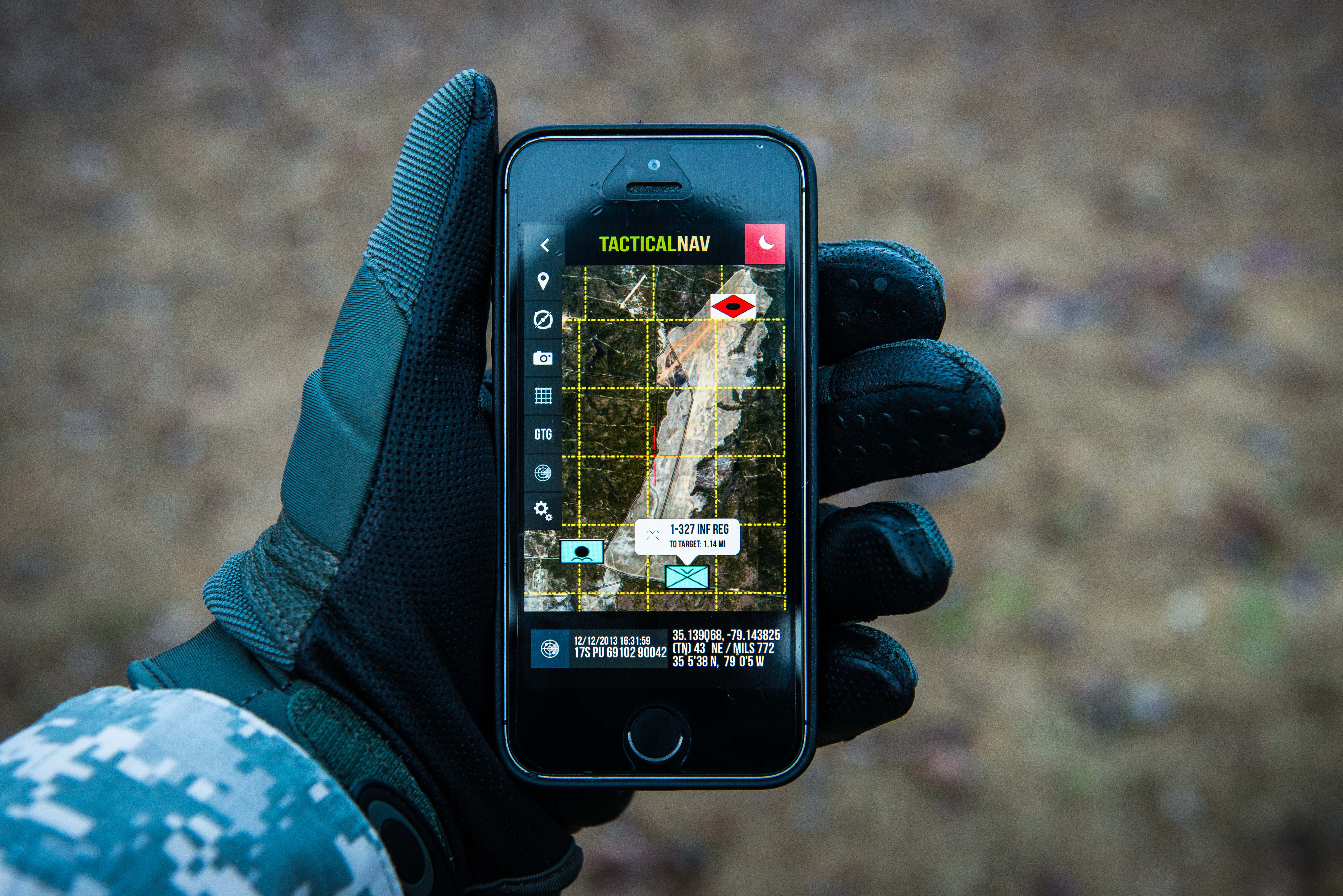
AppDaddy’s Tactical Nav for iPhone just received an update to mirror the recent Tactical NAV HD release. The Tactical NAV app now supports the following features:
* Military quality GPS tactical navigation system
* WGS 84 standard
* Tested in combat to ensure utmost accuracy and reliability
* 1:50,000 map scale overlay (1km by 1km gridsquares)
* Waypoint plotting functionality
* Fully editable waypoints
* Location and waypoint sharing via email with other users
* Compass lock function
* Fast user switching between degrees, Mils, elevation, LAT/LONG, and MGRS data
* Camera mode with heads-up data displayed in real-time with photo stamping ability
* One-button night mode function
* “Go to Grid” option
* Multi-tasking support
itunes.apple.com/us/app/tactical-nav/id412650650?mt=8
Sounds promising but I would be interested to know who tested this “in combat”. Any real world independent feedback?
No. It is definitively *not* a military quality GPS system. This is an iPhone application, for heaven’s sake.
Consumer devices can only utilize the civilian (SPS) GPS service, *not* the military (PPS) service. That is, the HW and SW only support the unencrypted C/A signal, not the P(Y) signal. As such, civilian-grade GPS systems are much more susceptible to jamming and spoofing ECM.
Relying on iPhones in combat will get people killed – on the wrong side – if some future adversary has a meaningful EW capability.
Besides, consumer electronics, smart phones in particular, lack the field-usability of military equipment. Sure, there are covers, external batteries and such to address this, but hardly to the level of dedicated military equipment. There are environmental mil standards for a reason.
I own this app, use it, and enjoy it. But it has a serious deficiency of not currently supporting offline maps and waypoints.
In a perfect world, I’d pull my own topo maps into this app, use it as the sandtable, and drop in waypoint coordinates pulled from my proper GPS.
Like M5 says: counting on a positive phone signal is a mistake waiting to happen.
This app might also be useful in urban SAR (Search And Rescue) scenarios, with the previso that in the event of a major disaster it will not work without cell service. Also there is negligible documentation perhaps because it ties in with military training in some way?
(Is Afghanistan totally covered with wireless phone service?)
There is another app called GaiaGPS that has many of the same features, waypoints, etc. that does provide the ability to download a variety of maps that can then be used off line, and is probably more useful for back county travel, if you don’t have call in an airstrike or artillery target.