During my military career, I spent a great deal of time working with various Mapping, Charting, and Geodesy (MC&G) products and I can tell you that I am impressed with this. 3D Models have been available for years, but at a premium price and to a select customer base. Additionally, they were fragile. 3D-TTM has alleviated these issues.
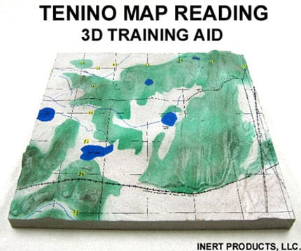
Manufactured from foam, the 3D Terrain Maps are durable and can be written on with dry erase markers. Each tile is 2′ x 2′ and can be combines with adjacent maps to create as large a 3D model as needed.
The map is reproduced including all marking such as gridlines, but terrain features are “brought to life” and rendered in full 3D. This gives the use a real appreciation for contour lines found on a flat map. Check out the example below of the infamous “Tenino” map used for basic map reading training throughout the Army.
In addition for the obvious use by NCO academies, ROTC detachments, and Advanced Individual Training courses they are perfect for training locations that are used regularly such as NTC, JRTC, and even local ranges. Another interesting idea is to also have terrain maps produced for areas where a unit is constantly operating to allow small unit leaders to conduct detailed sand table briefings. I can also see these coming in handy for Law Enforcement as well as public safety professionals.
Check out www.3dtacticalterrainmodels.com for more info.


