The Defense Advanced research Project Agency funds a wide variety of tech development programs but rarely does the capability developed for one end up changing the lives of a completely different profession. This is the case when capabilities identified during the Persistent Close Air Support program were used for the Fire Line Advanced Situational Awareness for Handhelds (FLASH) program to aid firefighters.
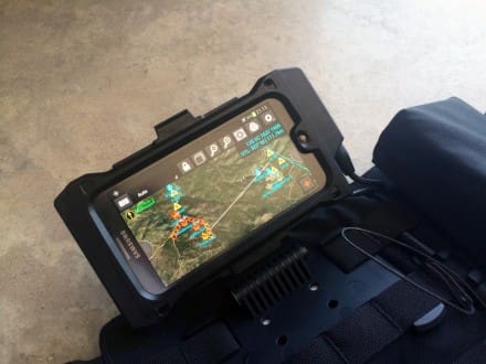
FLASH utilizes tablet computers, aircraft-mounted sensors and radios to link everything together. It is designed to identify the location of every firefighter and firefighting aircraft in expansive fire zones. The system overlays multiple streams of information visually via a tablet to each firefighter and the fire command post onto a digital map.
The results of a recent 3-day exercise were promising. Much like on a modern battlefield, firefighters on the ground and controllers in a command post in Prescott, Arizona as well as observers in Virginia had access to the same information. It increased situational awareness and personnel accountability. Both are critical to successful firefighting. In fact, the exercise took place not far from where 19 firefighters from the Prescott Fire Department’s Granite Mountain Hot Shots unit gave their lives just one year ago on June 30, 2013, battling the Yarnell Hill wildfire.
Not only does the FLASH technology increase the safety for firefighters but it also helped them find fires more quickly. But that advantage doesn’t stop there. They also ran a separate but related demonstration of search and rescue for an injured hiker. Triangulating from the person’s 911 call, the FLASH-equipped team found the person within 15 minutes. Normally, this can take hours or even days.
According to DARPA, several performers participated and made the demonstration and training possible:
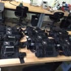
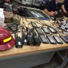
-Persistent Systems LLC developed the tactical radio
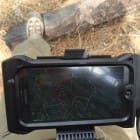
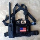
-Juggernaut Defense developed the case for the tablet, radio/tablet cabling and vest to hold the equipment
-AvWatch provided the aircraft with mounted sensors for the training
-The Digital Precision Strike Suite team from Naval Air Warfare Center Weapons Division at China Lake, California, provided the FLASH software and integrated the various systems
In fact, the Prescott Fire Department continues to use the equipment and DARPA is developing training materials.
Thanks to Juggernaut Defense for the heads up and the photos!
Tags: DARPA, Juggernaut Defense



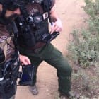
Can anyone ID that truck in the middle photo with the full sunroof over the passenger area? Never seen one like that outside that trip I took to Jurassic Park. Thats pretty cool.
Jeep Cherokee
Ford Flex?
Land Rover
“The Defense Advanced research Project Agency funds a wide variety of tech development programs but rarely does the capability developed for one end up changing the lives of a completely different profession.”
You mean the internet doesn’t count?
Sorry, couldn’t resist…
Apparently, “rarely” isn’t a word you learned in school.
Al Gore invented the internet when he was head of DARPA
Would like to know more about how they are fielding devices with cached orthoimagery.. or if the devices require a cellular connection. If those map builds are local to the device and are easily modified, that could work well here in off grid Alaska.
The map imagery is local on the devices and is created using a tool called MOBAC. Mobile Atlas Creator, which is an open source project hosted on Sourceforge. The key to the system is the MANET radios but I imagine you could make this work with something like the Serval Project – using your phone’s rf equipment to establish the mesh in an ad-hoc manner.
The map imagery is uploaded to the device prior to rolling out. No cellular connection is necessary as all of the imagery is stored in a folder on the SD card or device and the application uses this data to display sat maps, terrain detail, and elevation data.
Thank you, gentlemen.
Very nice; kind of a “swords into plowshares” idea. Always nice to see mil tech trickle down.