DroneShield, an Australian/US global leader in Artificial Intelligence based platforms for protection against advanced threats such as drones and autonomous systems, has today announced an enhanced version of its DroneSentry-C2 Command-and-Control software, in partnership with location intelligence firm, Nearmap. Nearmap provides city-scale 3D content, artificial intelligence data sets, geospatial tools, and high-resolution aerial imagery in Australia, New Zealand, and North America.
DroneSentry-C2 provides an intuitive and feature-rich software platform, providing counter-UAS awareness and reporting capability. It integrates both DroneShield and third-party C-UAS sensors and effectors. Those include multiple AI-enabled sensing and tracking products, such as RfOne long-range direction-finding sensors for UAS detection and tracking, and camera-agnostic DroneOptID optical/thermal camera AI software.
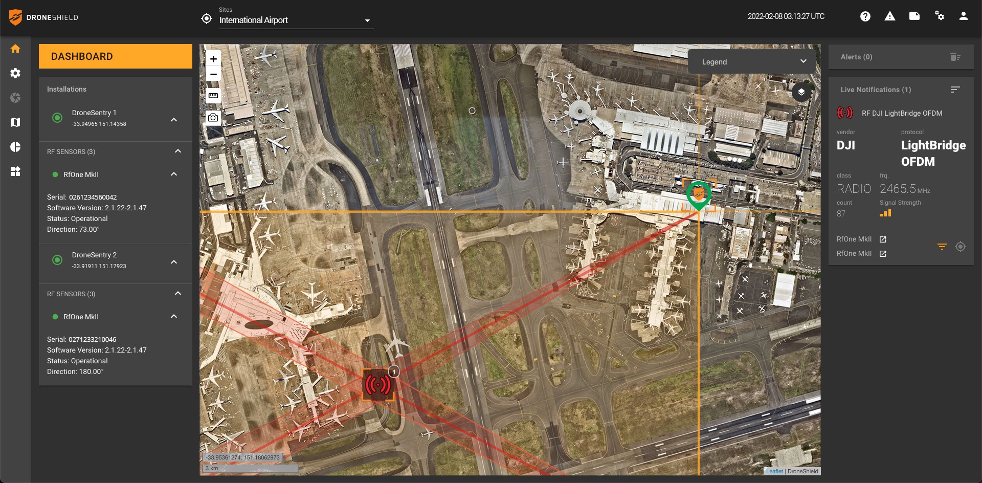
DroneSentry-C2 will come with a standard mapping solution for cost-sensitive customers, and an optional Nearmap mapping upgrade for best-in-class mapping data for high-performance environments, such as Government, intelligence, Homeland Security and defence markets, when precision and quality are critical.
The system receives regular secure software updates, capitalising on years of DroneShield’s extensive experience in the C-UAS arena.

DroneSentry-C2 with Nearmap location data
The software comes as an on-prem, air-gapped solution which focuses on intelligence, Homeland Security and defence users, or secure cloud for enterprise customers. The on-prem solution also includes a high-grade physical server. Both options come with regular mapping updates, including ability for the user to load own maps, for sensitive locations.
Oleg Vornik, DroneShield CEO, commented, “One of DroneShield’s differentiators is that we are both a sensor manufacturer and an integrator. Providing a streamlined and standardised hard/software bundle that gives our user community an easy to deploy and run command-and-control software, will be critical, as more fixed and pop-up site users seek to deploy counter-UAS products. Importantly, the offering is already validated by deployments such as US Air Force and Australian Army, amongst number of other tier 1 end users globally.”
Dr Rob Newman, Nearmap CEO and Managing Director, said, “Our customers tell us they prefer Nearmap because of the quality, city-scale coverage, and currency of our location intelligence offering. Combine this market-leading geo-spatial capability with DroneShield’s innovative software, and the ability to defend against the threat of autonomous aerial vehicles, including drones, is even more powerful.
“Nearmap continues to drive innovation in the use of geo-spatial data and tools. This includes harnessing location intelligence to help organisations plan smart cities of the future, support the growth of greener spaces, and assist recovery efforts after major natural disasters.”

