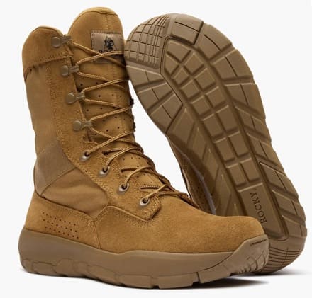
Salomon Forces Genesis MID GTX

Archive for the ‘Admin’ Category

Owl Cyber Defense Launches XD Air 6: Portable Kiosk Catches Zero-Day Threats Signature-Based Tools Miss

Friday, August 14th, 2026

XD Air 6, a rugged kiosk built to perform where standard hardware doesn’t hold up, empowers government agencies to evaluate file safety faster, using a known-good approach.

COLUMBIA, MD, August 12, 2026 – Owl Cyber Defense®, a global market leader in hardware-enforced cross domain and data diode network security solutions, today announced the launch of XD Air™ 6, an all-in-one portable kiosk built to inspect and sanitize files transported via portable media and stop threats that conventional antivirus cannot catch. XD Air 6 evaluates an extensive number of file types and media using a known-good approach to catch zero-day exploits and targeted attacks before they ever reach a network, giving security teams confidence in every file that crosses the boundary.
 
“XD Air 6 answers a simple question: how do you know a file is safe before it ever gets inside,” said Tim Fahl, CTO of Owl Cyber Defense. “Most security tools only catch what they’ve already seen before. XD Air 6 is purpose-built to take a different approach, checking each file meets our expectations, so zero-day exploits and targeted attacks get caught before they ever reach a sensitive environment. For the defense and high-assurance mission we support, that’s the difference between hoping a file is safe and knowing it is.”
 
XD Air has already proven itself across an extensive range of government and critical infrastructure applications worldwide; XD Air 6 builds on that trusted foundation with a new generation of file inspection and sanitization capabilities. It pairs multiple antivirus scanners with dual Content Disarm and Reconstruction (CDR) engines, powered by industry-leading providers including Glasswall and PuriFile®. Each engine is individually licensable, so organizations can match protection to their own mission needs and budget. XD Air 6 runs on a hardened operating system and is powered by Panasonic’s rugged Toughbook 40, bringing full protection to secure facilities, forward operating locations, and tactical environments without asking teams to sacrifice reliability for portability. Together, these capabilities give security teams a single, repeatable checkpoint that keeps malicious and mobile content out of the world’s most sensitive networks, without slowing operators down or adding new training burden.
 
To learn more about XD Air 6, reach out to our team today.

Cana Provisions Expands to Europe and the United Kingdom with Two New International Distributors

Friday, August 14th, 2026

Huntsville, AL — August 14, 2026 – Cana Provisions today announced its expansion into the European and UK markets through partnerships with two established tactical distributors: Gear Town in the Netherlands and Tactical Kit in the United Kingdom. The move brings much of the Cana Provisions product line directly to civilians, law enforcements, and military users across the region, with Tactical Kit servicing the United Kingdom and Gear Town servicing continental Europe and beyond.


As demand for reliable, portable water treatment continues to grow among operators, agencies, and preparedness-minded civilians across Europe, the partnerships give customers regional access to Cana’s water treatment and solutions — without the cost and delay of international ordering.

“Clean water isn’t a domestic concern; it’s a universal one. Partnering with Gear Town and Tactical Kit lets us put proven water solutions directly into the hands of the people who need them, wherever the mission takes them.” said Zach H, Owner of Cana Provisions.

Cana Provisions products are built for broad-spectrum operations, disaster response, training environments, and austere expeditions where contaminated water sources are the norm. The company’s mission is to ensure users can treat, verify, and consume safe water without external reference.


Available Products:

• H2gO Mobile Disinfectant Generators and accessories

• Qore Performance Water Data ICEFLASK® and ICEFLASK® Water Data Decals

• Select Cana Provisions Water Data Cards and Decals

• Cana Provisions Water Data Nalgene Bottles

• MSR and Platypus GravityWorks filter systems and accessories

To request additional product availability or to place unit orders, please contact the distributors directly:

Europe — Gear Town

Website

Email: support@geartown.eu

Dutch Inquiries: 085 744 4947

International Inquiries: +31 85 744 4947

* photo by Austin Miller, @Eastcorner Industries.

United Kingdom — Tactical Kit

Website

Email: sales@tactical-kit.co.uk

Phone: 01778 561672

* photo by Adam Wakefield, @81 Photography

Polite Society Industries Launches Premium Silencers – Rimfire Through .36 Caliber

Thursday, August 13th, 2026

Polite Society Industries Launches Premium Silencers – Rimfire Through .36 Caliber

Built to Last. Priced to Own.

TAMPA, Fla. (August 12, 2026) — Polite Society Industries (PSI) today announced its first line of premium silencers, covering rimfire through .36 caliber and designed by a team of industry veterans.

“We designed our silencers around what laser powder bed fusion makes possible,” said Jon Scott, president of Polite Society Industries. “You can form geometry inside a silencer that nobody would have considered ten years ago and put material only where the part actually needs it. What comes out is light, durable in the places that take the abuse, and does its job. Weight, strength, and suppression used to be a trade – you gave up one to get another – but not anymore.”

Every PSI silencer carries the same promise. If used properly and it breaks, the company fixes it. If it cannot be fixed, it is replaced. If it cannot be replaced, the customer gets their money back.

“Until this year, you waited the better part of a year for a silencer, and if something went wrong, making it right could mean starting the federal paperwork over and waiting all over again for something you had already paid for,” Scott said. “That wait is largely now over. We wrote our warranty to be used when needed.”

Pricing follows the same thinking. “A silencer costs less to build today than it did ten years ago, and that is true across this industry,” continued Scott. “But the prices people are used to were set when a silencer took the better part of a year and two hundred dollars in tax to get. Scarcity like that keeps prices high on its own. That scarcity is gone. It seems more polite to pass along the savings than to keep pricing for a market that no longer exists.”

The phrase “An armed society is a polite society,” from Robert Heinlein’s book Beyond This Horizon, is the philosophical position on which PSI is founded. Politeness is a choice people make when they have every capacity to impose and choose not to, and PSI products make that choice easier.

For full specifications, pricing, and a guide for first-time buyers, visit PoliteSocietyInd.com.

SETAF-AF Hosts Joint Ghanaian Delegation to Advance Partner Drone Production

Tuesday, August 11th, 2026

VICENZA, Italy —

U.S. Army Southern European Task Force, Africa (SETAF-AF) hosted Ghana Armed Forces representatives for a showcase of U.S. unmanned aircraft systems innovation, technical management and production capabilities at Caserma Del Din in Vicenza, Italy, July 21-22.

The five-member delegation represented Ghana’s army, navy and air force, and included leaders and planners ranging from the battalion to branch headquarters. It was the first time Ghanaians visited SETAF-AF to discuss UAS, and the first time Ghanaian officers toured the 173rd Airborne Brigade’s Bayonet Innovation Team lab.

“The GAF are exceptionally professional and capable partners,” said U.S. Army Maj. Stephen Scuderi, the Ghana desk officer with the Security Cooperation Directorate, SETAF-AF. “While we are assisting the GAF in standing up their own drone production, this effort paves the way for future joint co-production opportunities and access to their training ranges to test and mature our own UAS and counter-UAS technology in different environments.”

Scuderi explained that Ghanaian leadership is focused on independence, self-reliance and locally developed solutions. They want to design and manufacture UAS capabilities tailored precisely for their specific regional environment, with a long-term goal of exporting those systems to West African regional partners.

This engagement builds upon a bilateral UAS partnership first discussed in 2025 between the U.S. Army Europe and Africa commander and the Ghanaian chief of army staff.

“Our primary goal was to demystify in-house drone manufacturing and show the Ghanaians exactly how the U.S. Army executes this at the tactical level,” Scuderi said.

The delegation spent its first day at the 173rd Airborne Brigade BIT’s lab, reviewing in-house manufacturing capabilities and observing a live UAS flight demonstration. The day ended with a question-and-answer session on manufacturing techniques, UAS training and rapid maintenance cycles.

On the second day, SETAF-AF experts briefed the delegation on electromagnetic spectrum control and electronic warfare in active UAS environments, airspace integration and management protocols, counter-UAS defense frameworks, and UAS intelligence exploitation.

While the U.S. Army and the GAF differ in size and budget, the localized production model utilized by the 173rd Airborne Brigade BIT is highly scalable and replicable for GAF forces. The intent was to provide the GAF delegation with a realistic, proven blueprint to help them lay the foundation for their own drone manufacturing capability.

U.S. Army Capt. Vincent Gasparri, director of the 173rd Airborne Brigade BIT, said the technical exchange ran in both directions.

“The BIT’s primary goal was to explain the lessons we have learned pursuing UAS in the 173rd Airborne Brigade to the GAF to support their similar efforts,” Gasparri said. “We also wanted to learn what advancements and work the GAF have made with respect to UAS that can inform our efforts internally.”

Gasparri noted that Ghana has faced technical challenges the 173rd has not, like extreme heat impacting battery life, which prompted internal consideration and planning for advancements in that area as well.

“Our team’s experience with the GAF has been informative because it provides insight into alternative environments, and military challenges and progress within UAS,” Gasparri said.

Ghana’s weather, supply chains and operating environment differ from Europe’s, and accounting for those differences ensures U.S. systems and designs hold up across a wider range of conditions.

“It also serves to further shape the capacity and value that can come from a drone center of excellence and training area in Ghana for both the GAF and U.S. forces,” Gasparri said.

To move discussions toward fielded capability, SETAF-AF is brokering partnerships between Ghanaian research institutions and U.S. universities and research centers, as well as securing collaboration with U.S. private industry partners.

Scuderi pointed out that these partnerships run parallel to and complement the line of effort to establish the Africa Multidomain Training and Experimentation Center in Morocco. Together, the two efforts contribute to a wider goal of fostering standardized partner-nation UAS proficiency and shared multidomain understanding across Africa.

“This engagement serves as a model,” Scuderi said. “SETAF-AF stands ready and willing to collaborate with African nations to drive innovation, whether in UAS or other emerging technological sectors.”

WEPTAC Range Day 2027

Tuesday, August 11th, 2026

The annual WEPTAC Range Day takes place on Monday, January 18, 2027, to coincide with SHOT Show Week. This is a DoW-centric event. Industry, this is your place holder.

Attached is the event flyer. Registration prices and more details to come. In the meantime, please confirm your vendor attendance to RANGEDAY@WEPTAC.COM.

DroneShield Launches RfRecon, Marking the Evolution from RF Detection to RF Intelligence

Tuesday, August 11th, 2026

Enabling operators to detect, locate, and understand activity in the RF environment – from a single portable platform.

Sydney, Australia – 10 August 2026DroneShield (ASX:DRO), a global leader in advanced counter-drone (CUAS) technology, today announced the launch of its latest flagship product, the RfRecon, a portable RF intelligence solution designed to help defence, government, and security organisations better understand the electromagnetic environment wherever operations occur. 

Built on DroneShield’s recently launched proprietary RfAI-3 intelligence architecture, RfRecon enables operators to rapidly sense, identify, locate, and assess RF activity from a single device. Rather than simply collecting spectrum data, it provides the operational context needed to support faster and more informed decisions in the field.   

Modern operations increasingly depend on understanding the electromagnetic environment. The rapid growth of uncrewed systems, electronic warfare capabilities, and wireless communications has dramatically increased the volume of complexity of RF activity surrounding today’s operators. While sensing technologies have become more capable, interpreting that information still requires multiple systems, specialist expertise, or time-consuming analysis.

RfRecon was developed to change that.

By combining ultra-wideband spectrum awareness, precision direction finding, and RfAI-3-powered signal intelligence within a single portable capability, RfRecon delivers immediate operational understanding while reducing operator workload and accelerating decision-making at the tactical edge.


Image: RfRecon powered by RfAI-3 senses unknown RF activity surrounding today’s operators.

RfRecon delivers a step change in capability versus previous industry adopted solutions, combining approximately six (6) times more radio frequency spectrum coverage, four (4) times greater processing and AI compute, thirty-one (31) times more storage, and eight (8) times more memory, while introducing advanced capabilities such as direction finding, Bluetooth and Wi-Fi, Remote ID, AIS/ADS-B detection, integrated GNSS, and hardware-based security. Collectively, these enhancements position RfRecon as a significantly more capable and future-ready sensing platform.

“The electromagnetic spectrum has become one of the most important sources of operational intelligence on the modern battlefield, but collecting data is no longer enough,” said Angus Bean, Chief Executive Officer of DroneShield. “The teams that gain the greatest advantage will be those that can rapidly understand what they’re seeing and confidently act on it. RfRecon reflects that shift by bringing RF intelligence directly to the tactical edge”.

RfRecon is designed to operate within a layered defence architecture, extending RF intelligence from the tactical edge to enterprise command-and-control. The capability supports dismounted, vehicle-mounted, expeditionary, and fixed-site operations, and its open architecture and support for industry-standard data transfer enable rapid integration into existing security and defence ecosystems.


Image: RfRecon’s multi-mission design extends RF intelligence from tactical edge to enterprise command-and-control.

RfRecon interoperates with the tools operators already rely on, including ATAK, third-party command-and-control platforms, and complementary sensor technologies. It can also form part of layered counter-UAS architectures incorporating cyber takeover and kinetic defeat capabilities. Whether deployed standalone or integrated into broader mission systems, RfRecon helps organisations build a more complete understanding of activity across the electromagnetic environment. RfRecon will continue to benefit from ongoing enhancements delivered through DroneShield’s software roadmap, ensuring customers gain access to future improvements in RF intelligence capabilities over time.

RfRecon is available immediately for qualified defence, government and security customers worldwide. 

Giving Time Back to the Rifle Company

Saturday, August 8th, 2026

By First Lieutenant Max Steinbach and First Lieutenant Collin Bergstrom, United States Marine Corps

First Lieutenant Max Steinbach is a Marine infantry officer serving as the company executive officer for Echo Company, 2d Battalion, 4th Marines. First Lieutenant Collin Bergstrom is a Marine infantry officer and a rifle platoon commander in the same company. The two of them built Scheme O, a planning tool for small-unit leaders, and they disclose that interest at the end of this article.

Abstract

Over the past two years the United States and its allies have pushed artificial intelligence into the planning and targeting work of combatant commands and alliance headquarters. Four echelons down, in the company office where plans become action, most leaders are still working with tools that were never built for the job. This article argues that what slows planning at that level is not a shortage of decision making but hours of mechanical labor.

To set the scene, it is late in the company office the night before an order is due. One platoon commander has a map, a protractor, and a fine-tip pen. Another is losing in a battle with a general-purpose mapping website, like CalTopo. A third is rebuilding the same concept-of-operations slide for the third time tonight, because the scheme of maneuver has changed again and the screenshot on slide four is now wrong.

Elsewhere in the same profession, planning looks nothing like that. In 2025 the Marine Corps licensed Palantir’s Maven Smart System for the entire service. NATO fielded its own variant across Allied Command Operations and declared it fully operational in June 2026. During Operation Epic Fury in March 2026, the commander of United States (US) Central Command, Admiral Brad Cooper, told reporters that advanced artificial intelligence tools were turning work that once took “hours and sometimes even days into seconds.” In January 2026 the Department of War (DOW) directed the services to become an “AI-first” force, front to back.

None of this investment is misplaced, nor should advanced capabilities be distributed evenly across every echelon. But at the bottom of the curve, the problem is not simply a smaller version of the one facing higher headquarters; it is a different problem altogether. Company and platoon commanders do not need artificial intelligence to choose a support-by-fire position. They need the repetitive mechanics of planning to stop consuming the time that they should be giving back to theirplatoons—and, most importantly, to the Staff NCOs, NCOs, and junior Marines and soldiers responsible for carrying out the plan.

The Friction Tax

The one-third, two-thirds rule is meant to protect preparation time: leaders use no more than one-third of the time available to develop the plan and leave the rest to those responsible for executing it. That time is taken from the platoon receiving the order late, the squad leader who must translate it into action, and the Marines left with fewer hours to rehearse, inspect their equipment, understand their roles, and prepare for the mission ahead.

At the company and platoon level, that time is rarely lost because the tactical problem is unusually difficult. It is lost due to mechanics. Building a scheme of maneuver by hand or in general-purpose software requires plotting dozens of grid coordinates, calculating grid and magnetic azimuths, accounting for declination, tracing weapon ranges and lines of sight, and drawing the battlespace geometries that keep supporting fires away from friendly forces. Then the plan changes—as plans always do—and much of that work must be repeated. One of our own planning sessions consumed nearly eight hours across two days in a general-purpose mapping tool. The result, shown below, was an overlay that was harder to brief than the plan it was trying to convey.

Figure 1. A company plan built over two days in a general-purpose mapping platform. Every marker, line, and polygon was placed and labeled by hand. Authors’ screenshot.

That is not a skill problem. Small-unit leaders analyze a mission, read terrain, and turn intent into action, and they are good at it. The friction lives in the tooling.

Learn It by Hand First

None of this is an argument against analog planning, and we want to be blunt about that before going further. Map pens, protractors, compasses, and acetate are not quaint traditions. They are fundamentals. A leader who cannot read a map, plot a grid, shoot an azimuth, account for declination, and build an overlay by hand has no business using software that does those things for him, because he cannot tell when the output is wrong and he cannot function when the battery dies, the screen cracks, or the network drops. Degraded operations are not a thought experiment, and a fallback only works if somebody trained it.

The comparison we keep coming back to is basic math and the calculator. We make students do math by hand not because calculators are scarce, but because someone who does not understand the arithmetic itself cannot spot a wrong answer. Once that understanding is there, nobody asks an engineer to do long division on paper as a character-building exercise. Learn the map, plot the grids, and measure the azimuths until it is second nature. Then stop spending three hours a night on work that purpose-built software can finish in ten minutes.

General-Purpose Tools, Purpose-Built Problems

Most leaders who move past hand-drawing end up in a general-purpose mapping platform like CalTopo, which is a reasonable landing spot and no knock on those products. They are very good at what they were built for: recreation, land management, search and rescue. What they were not built around is gun-target lines, minimum safe lines, the MIL-STD-2525 military symbol set, or the production cycle of an operation order. So, the infantry leader does translation work, and the friction stays, because the tool has no idea what its user is trying to produce.

Closing the Gap with Scheme O

We are two infantry officers, and after enough nights redrawing the same graphics, we built the tool we wanted. Scheme O is organized around the small-unit planning cycle rather than around a map. It makes no tactical decisions, on purpose. It does not choose the support-by-fire position, sequence an assault, or decide where the casualty collection point goes. It measures, plots, draws, redraws, and formats outputs, which is exactly the work that was taking our time.

Battlespace Geometries from Three Inputs

The foundation of the platform is its ability to generate battlespace geometries from three inputs: a friendly position, an enemy position, and the gun-target line between them. Select the weapon system, and Scheme O calculates the required azimuths, builds the minimum safe lines, and places the geometry directly on the map. The underlying logic for the platform’s default geometries is derived from the weapons-safety standards and surface-danger-zone criteria contained in Army Regulation 385–63 and Marine Corps Order 3570.1D. Users can also build custom geometries tailored to specific range regulations, ordnance, or unit procedures, then save and reuse them across future plans rather than rebuilding them from scratch. Declination between grid and magnetic north is handled automatically for the unit’s location, and every azimuth and boundary updates continuously as positions move.

Figure 2. A battlespace geometry generated from three inputs: friendly position, enemy position, and the gun-target line between them. Authors’ screenshot.

Symbology That Reads Correctly

The operational terms and graphics catalog is drawn from exact MIL-STD-2525 assets rather than from shapes improvised to look close enough, so every friendly, enemy, weapon-system, and control-measure symbol carries the right frame, affiliation, and echelon. Nobody should be hunting for a symbol or building one out of triangles at 2200.

Figure 3. The operational terms and graphics catalog, built on exact MIL-STD-2525 symbology. Authors’ screenshot.

Lines, Control Measures, and a Tape Measure

Phase lines generate off a northing or snap to exact grids when they must match guidance from higher. Boundaries, multi-point lines for enemy obstacles, and shapes that define engagement areas or range limits take a few clicks and produce grids for every point, which makes them easy to read back during a confirmation brief. To quickly measure, hit the measure tool, select any two points and the tool returns distance and direction without anyone reaching for a protractor.

Figure 4. Lines, boundaries, and shapes, drawn quickly or snapped to exact grids. Authors’ screenshot.

Routes and Time-Space Analysis

Trace a route by clicking along the desired path and Scheme O assembles it in real time: waypoints land on their own, checkpoints take a single click, and the numbering sequences itself. Every leg reports grid and magnetic azimuths and distance in meters, feet, kilometers, or miles. Enter a pace and a start time and the tool returns total movement time and an ETA at every checkpoint. Or work the problem backward: give it a no-later-than time and Scheme O calculates the pace required to make the timeline, with a departure time to match.

Figure 5. Route planning with automatic checkpoint sequencing, per-leg grid and magnetic azimuths, and time-space analysis. Authors’ screenshot.

Seeing the Terrain Before You Walk It

Viewshed analysis runs from any position at a specified observation height and returns what that position can see and what it cannot. Range rings tie to a symbol on the map, so the threat’s observation and fields of fire appears the moment the enemy picture does, and engagement areas stop being a matter of argument.

Figure 6. Viewshed analysis and a range ring generated from an enemy position, showing observation and dead space. Authors’ screenshot.

There is also a three-dimensional terrain mode, which is the feature our platoon commanders use most for a rehearsal.

Figure 7. Three-dimensional terrain mode, used to study how a plan sits on the ground before anyone steps off. Authors’ screenshot.

Fires and Close Air Support

Select an enemy position and the tool generates final attack headings, their reciprocals, maneuver buffers, and minimum safe distance rings. All of it is adjustable in length and visual weight.

Figure 8. Final attack headings, reciprocals, and a minimum safe distance ring generated off an enemy position. Authors’ screenshot.

From the Map to the Order

A data matrix consolidates every position, grid, route, and geometry in the plan into text that can be pasted directly into an operation order or PowerPoint brief. Instead of spending hours on meticulous manual measurements and transcription, platoon commanders can focus on whether their tactical decisions are sound. A growing set of templates also pulls weather, illumination, first and last light, etc., into a format that drops directly into the orientation paragraph.

Figure 9. The data matrix, which collects every position, grid, route, and geometry into text that can be pasted into an operation order. Authors’ screenshot.

Products That Survive a Change of Plan

The plan can also be exported to PowerPoint as individually movable objects rather than a single flat screenshot. We built this feature after Lt Bergstrom and I spent far too many hours rebuilding slide after slide for briefs to the MEU whenever the plan changed.

Figure 10. The same plan exported to presentation software, where each symbol, route, and control measure remains a separate movable object. Authors’ screenshot.

Two Evolutions, Reported Honestly

We first used Scheme O as a company during PHIBRON-MEU Integration Training, where compressed shipboard timelines made it an honest test of the workflow. In previous evolutions, company- and platoon-level planning required hours of manual measurements, handwritten grids, individually constructed geometries, and slides rebuilt whenever the plan changed.

With Scheme O, the company and platoons worked from the same planning picture. Geometries were generated, grids populated, and briefing products exported rather than rebuilt. Both levels recovered several hours for enemy analysis, tactical refinement, rehearsal, and—most importantly—preparing the Marines who would execute the plan.

We used the platform again during the Amphibious Ready Group/Marine Expeditionary Unit Exercise, and the result held. The company and platoons again recovered several hours, while receiving updated planning products earlier and avoiding the need to recreate work already completed at another level.

The exercise also revealed two uses we had not anticipated. Amphibious Combat Vehicle sections used Scheme O to coordinate a boat lane with the ship through a shared picture with headings and distances already calculated. We also used its overlays for an interactive tactical decision game, allowing leaders to build, share, and compare schemes of maneuver on the same terrain.

Conclusion

The joint force is right to invest in speed and advantage at its highest levels. But modernization should also reach the company and platoon leaders who translate those decisions into action. At their level, the greatest opportunity may be better tools for the routine frictions of planning—the measurements, graphics, calculations, and products that consume time.

The fundamentals must remain. Leaders should know how to plan with a map, compass, and protractor when conditions require it. But the mastery of those skills should provide a foundation, not impose a permanent workflow. The next step is to measure where time is being lost, listen to the practitioners closest to the problem, and give them the freedom to adopt better tools. Every hour recovered from the friction which the current mechanics of planning produce is another hour returned to analysis, rehearsal, and most important, the Marines and Soldiers preparing to execute the mission.

Disclosure and Disclaimer

Conflict of interest: the authors created Scheme O and hold a financial interest in the company that develops it. They received no compensation for this article, and no government entity has endorsed, procured, or sponsored the platform.

The opinions expressed here are the authors’ alone and do not reflect the views of the Department of War, the United States Marine Corps, the United States Army, or any other government entity. Scheme O is a privately developed tool and is not an official system of, endorsed by, or affiliated with any government entity. All figures are the authors’ own screenshots of software they built, taken on unclassified training data, and contain no controlled unclassified information.

Accelerating Tactical Networking: How The New Silvus StreamScape 5.0.2.0 Firmware Upgrade Enables Faster, Safer and More Connected Field Operations

Wednesday, August 5th, 2026
  • Elevates StreamConnect security – now offers IPsec tunneling to bring AES-256 encryption directly to user data and IP headers, enabling secure mesh connectivity over 5G, SATCOM, or any global Layer 3 internet connection. 
  • Delivers enhanced voice performance for StreamCaster® 4000-series mobile ad hoc network (MANET) radios without requiring hardware upgrades. 
  • Boosts performance up to +6 dB of gain through transmit eigen-beamforming while utilizing select Spectrum Dominance 2.0 capabilities.

To enhance the operator experience and wireless performance in the field, Silvus Technologies, a Motorola Solutions company, has released its StreamScape 5.0.2.0 firmware update for StreamCaster? 4000-series MANET radios.

Available immediately as a no-cost upgrade from the Silvus customer support portal, StreamScape 5.0.2.0 rapidly transforms complex technical networking capabilities into operational advantages in the field. 

Neema Daneshvar, Vice President of Product at Silvus Technologies, highlighted the release’s impact:

“Today’s operators require more from their wireless communications—they need secure, globally connected networks that can be rapidly deployed and trusted in contested environments. StreamScape 5.0.2.0 expands what StreamCaster MANET radios deliver by strengthening tactical networking, enabling secure global connectivity through StreamConnect, and delivering new capabilities that improve mission effectiveness without requiring new hardware.” 

StreamScape 5.0.2.0 focuses heavily on real-world utility across four core operational pillars:

1. High-Level Security 

Security and operational ease no longer require a trade-off. 

Secure Site-to-Site Communications: The StreamConnect: Global Ad Hoc Network solution is now available with IPSec tunneling, bringing AES 256 encryption directly to user data and IP headers. Embedded exclusively in StreamCaster MANET radios, this free feature enables mesh networks to seamlessly connect over 5G, SATCOM or any Layer 3 internet connection to keep operations secure from anywhere in the world.

2. Reliable PTT Voice Communications in Challenging RF Environments 

StreamScape 5.0.2.0 optimizes voice performance under severe network constraints: 

Audio Stability Under Pressure: A brand-new, low-bandwidth voice codec designed to maintain legible audio communications even when network spectrum or data throughput is severely constrained. 

Simultaneous Multi-Group Monitoring: Expanded capabilities for the DualStream PTT Controller allow operators to monitor multiple active talk groups simultaneously using independent left and right audio channels. 

Clear Audio Across Massive Distances: Updates to the medium access control (MAC) layer dramatically improve audio performance and clarity across complex, large and highly dispersed multi-hop networks.

3. Significantly Slashed Setup Times 

StreamScape 5.0.2.0 automates critical parts of network deployment to accelerate setup: 

No More Manual IP Entry: Integrated DHCP Client support allows radios to automatically lease a virtual IP from a centralized server, eliminating manual static assignments. 

Simplified Maintenance: The new domain name system (DNS) client allows radios to resolve hostnames to IP addresses directly, removing the need for hard-coded IPs and reducing maintenance overhead when backend services change. 

Fluid, Real-Time Network Map: The reengineered topology view (Beta) inside the StreamScape graphical user interface (GUI) provides a more responsive, scalable and intuitive network visualization.

4. Maximized Range and Seamless Integration 

Up to +6 dB of Extra Gain: When utilizing select Spectrum Dominance 2.0 capabilities, proprietary transmit eigen-beamforming can now boost StreamCaster MANET radio gain by up to +3 dB on the SC4200 and +6 dB on the SC4400 without hardware upgrades, translating to longer range and deeper signal penetration. 

Elevated EW Resilience: The Dual Frequency Link capability now integrates with select Spectrum Dominance 2.0 features to support secure, uninterrupted communications. 

True Multi-Vendor Interoperability: Standard inclusion of the Unified Radio Data Model (URDM) Open API enables third-party unified control systems to natively manage StreamCaster MANET radios.

Total Network Control with StreamScape 

StreamScape is Silvus’ powerful, intuitive GUI that provides complete control of the Silvus mesh network from a single screen on any connected device. Built for rapid deployment and deep customization, it features simple drop-down menus alongside advanced diagnostic and performance tools, operators can quickly monitor network topology and optimize performance down to the individual node level. 

Learn More 

The StreamScape 5.0.2.0 firmware update is available immediately to Silvus Technologies customers as a free download via the customer support portal. For technical support reach out to support@silvustechnologies.com