
Referred to as an “Attack Pilot’s alternative to FalconView”, HawgView is an open source CAS planning tool created by NEO. Who is NEO? Well, that’s best answered in his own words:
Who am I? I am an A-10 driver first and only a software developer by hobby. Over the past decade, I’ve been flying CAS missions, trying to provide the best support possible to our heroes on the ground. I am still flying in the Air National Guard and plan to for as long as possible, but you will have to forgive me for not giving out my real name. Many of you know me, and I would be glad to talk with any of you over email if you have any questions. I just want to keep my personally identifiable information safe, for obvious reasons. In other words, I am one of you.
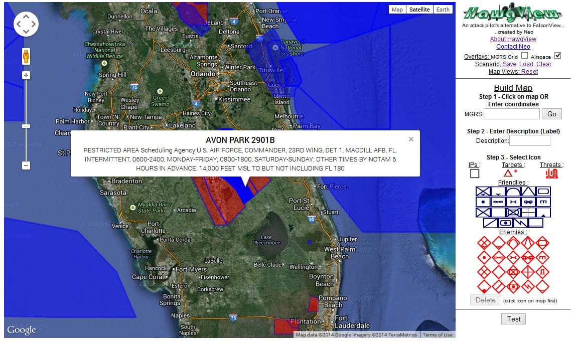
Below is a screen capture that will give those of you familiar with FV an idea of what is going on. Head on over and check it out.
At one time there was someone else using the source code to run another site that is similar but as of now, it seems to be down.
Thanks to TYR Group for find.
Tags: HawgView
This is an awesome website. I use it all the time as an MFFJM. Finding a 1:50,000 map for some DZ’s can be difficult, especially when jumping unmarked or new ones. Thanks NEO for your work on this.
This website is awesome. Having it tied into google earth, and the plotting tool makes it extremely versatile.
We have been using this in the Super Hornet community for a while, and i just came of a two week CAS det and this tool was invaluable, particularly for Urban CAS planning.
found out about this at TBS from a pretty cool grunt. It became my go to planning and nav tool and the fact that it’s so easy to input/pull MGRS and input graphics made it essential. Still use it for scouting out easy ground reference points for VFR flying and planning out camping trips.