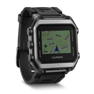
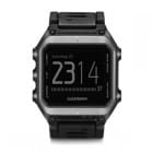
Imagine seeing where you are on a map or image just by glancing at your wristwatch. The Garmin Epix incorprates full color mapping, GPS/GLONASS and watch functions.

-1.4-inch high-resolution color touchscreen
-Worldwide shaded relief basemap
-8 GB built-in memory so you can load up on maps, such as TOPO U.S. 24K, BirdsEye Satellite Imagery, City Navigator and BlueChart g2 maps
-Preloaded TOPO 100K maps also available
-Fitness Training Apps
-Stainless steel EXO antenna with GPS/GLONASS reception
–Water rated to 50m
-Bluetooth enabled
Satellite Positioning
Earlier we mentioned both GPS and GLONASS functionality which is very exciting because you can access both US and Russian satellite positioning data. This feature just might come in handy if someone decides to use GPS jamming.
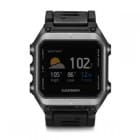
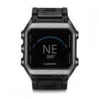
Altimeter, Weather and 3-axis Compass
If you are on the job and looking for Garmin products, contact Strohman Enterprise. I cannot say enough good things about how well Joe and his team will take care of you. They are my go-to for Garmin products.
Tags: Garmin, Strohman Enterprise


Man, regretting that Garmin Tactix purchase 8 months ago.
Exactly same sentiments here. That will teach me a lesson (once again) that coolest looking isn’t always the best functioning. I am actually thinking of selling the Tactix as I simply got frustrated with inability to see and deduct easily where the heck I actually am in general, from the watch when worn on wrist. The thing is simply unreadable. And I hacked it by loading extra maps too that were supposed to give you more info on LCD…
It’s only when I get back at my computer and load the trips in the BaseCamp for analysis that I can see it better and get the feel about the direction and ground covered.
Garmin has done this to me on multiple occasions–and I’ve been pretty shrewd about avoiding some of their missteps.
Just in time for summer, Garmin will announce a product that addresses flaws revealed by Epix’ early adopters…
Me want. Me get.
Joe is a good man and goes the extra mile for his customers – good to go in my book
Battery life? Is this something which we can recharge in the field with a solar panel/portable battery pack? Do we lose any data when changing batteries?
battery (24hrs in gps) maps 1-100k maps no one uses those apart from in e&e training bring 1-25k or at least 1-50k or make it a viable option for nav
Just to clarify the pixel res on the screen is to low to make anything but 100k maps viable for the purposes of navigation even with a screen as good as an Apple Watch nav is difficult using topo type maps below 1-50k due to screen size/area shown
Joe and Ashley ROCK! Great people and customer service!
Does anyone know about the battery life and whether it’s battery replacement or recharge?