
In 1959, the Navy built the first real satellite navigation system, which was called TRANSIT. The system was designed to locate submarines and started out with six satellites and eventually grew to ten. The subs often had to wait hours to receive signals from the satellites, but the model set the stage for accurate GPS with continuous signaling from satellites in space. The GPS project was launched in the United States by the Military in 1973 to overcome previous navigation systems’ limitations, integrating ideas from several predecessors, including classified engineering design studies from the 1960s.

In 1983 shortly after the Russians shot down Korean Air flight 007 after it wandered off course into Soviet airspace over the Kamchatka Peninsula, president Reagan offered to let all civilian commercial aircraft use the GPS (once it was completed) to improve navigation and air safety.
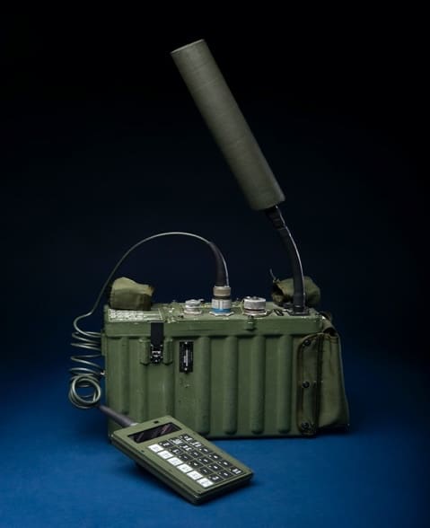
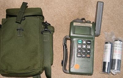
The original system used 24 satellites. It was initially developed for use by the United States military and became fully operational in 1995. When I first joined the Military in the late ’80s, the first GPS I used was the AN/PSN-8; you had to put it on an Alice pack frame and carry it by itself like it was a radio. Because it basically was the size of one. We would use a cargo strap to secure it to the back of the bolster seats on the RHIBS. It was used until after the 1st Gulf War. Later it was replaced by the AN/PSN-11 Precision Lightweight GPS Receiver (PLGR, “plugger”) that was used during the invasion of Somalia.
The network now consists of about 30 satellites orbiting the Earth at an altitude of 20,000 km. Not all 30 are in use; some are set aside as spears.
Since 1993, the US Air Force has made its Global Positioning System (GPS) available to the world, and ever since then, that technology has found its way into our everyday lives. Once it has information on how far away at least three to four satellites are, your GPS receiver can pinpoint your location thru trilateration (it also uses cell towers if close enough). The system is made up of three parts: satellites, ground stations, and receivers. Satellites act like the stars in constellations—we know where they are supposed to be at any given time. The ground stations use radar to make sure that you are where you think you are. The receiver is continuously listening for a signal from satellites. Just about everything, today can tell you your position on the Earth from your phone to your watch and dive computers.
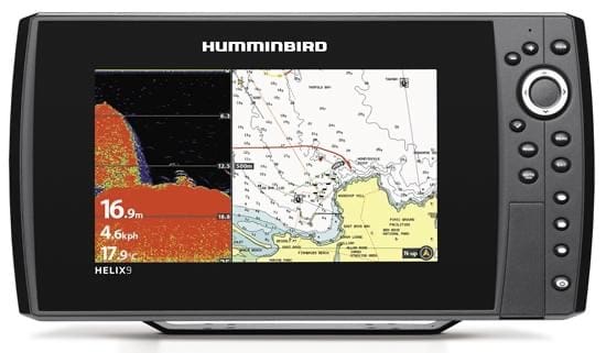
I remember when the first GPS watches came out, you had to make sure it had a clear view of the sky. You would also have to make sure the older military GPS’s had the most updated crypto in them, or it didn’t work and had to carry dead weight with you. Today there are a lot of options for handheld or even dive mask mounted. The SCUBAPRO Galileo HUD Pro can hold up to 31 GPS waypoints and a full dive computer. It will give you a compass heading, tell you the time and distance to your target. The one bad thing about all the civilian GPS is if there ever is a full out war, they will be the first things turned off. So, don’t forget the basics of time, speed, and distance.

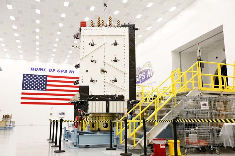
With two new satellites in orbit and eight more in various stages of development, the latest, GPS III, is already being built. The next generation of GPS should go fully operational around 2023.
The first GPS III satellite launched by Lockheed Martin cost an estimated $529 million to build. The satellite’s outstanding longevity will offset some of this upfront cost. Unlike the early GPS satellites, which have a design life of 7.5 years, the new GPS III satellites will last 15 years — twice as long as the oldest satellites in orbit and 25 percent longer than the latest satellites in the GPS fleet. The new GPS III satellite system is designed to adapt to new technology, and its mission objectives change. The next generation of GPS will be up to 3 times more accurate than existing GPS technology. That means the 5 to 10-meter accuracy you see now with current GPS technology will be more like 1 to 3 meters.
With all these improvements aimed at the civilian side of things, it’s easy to forget that GPS is first and foremost a military technology. There will be new command centers capable of controlling the existing GPS satellite and the new GPS III satellites from the ground. The next generation of GPS is expected to be available by 2022-2023.
They skipped over the Trimble Trimpack SLGR or “centurion” that came before the PLGR in the article. Easily took 30 minutes to get a lock, if at all. Only ones I saw work reliably were installed in helicopters. The man pack version was near useless for handheld /field operations.
Yeah, the AN/PSN-10 was freaking horrible when used at ground level, especially on the move. Main reason for that was the lack of satellites available during it’s early usage period. You typically always had trees obscuring you LOS to that second or third sat needed to get a good fix.
One positive was how well it fit in the center exterior pocket on a large ALICE /s/