SureFire

Archive for the ‘TacCraft’ Category

AFSOC’s 137th CTF Teaches Land Nav Skills During MST Training

Thursday, March 3rd, 2022

WILL ROGERS AIR NATIONAL GUARD BASE, Okla. —  

The 137th Combat Training Flight (CTF) taught 33 students land navigation, radio communication and radio programming skills during Mission Sustainment Team (MST) training held at Will Rogers Air National Guard Base, Oklahoma City, Feb. 7-10, 2022.
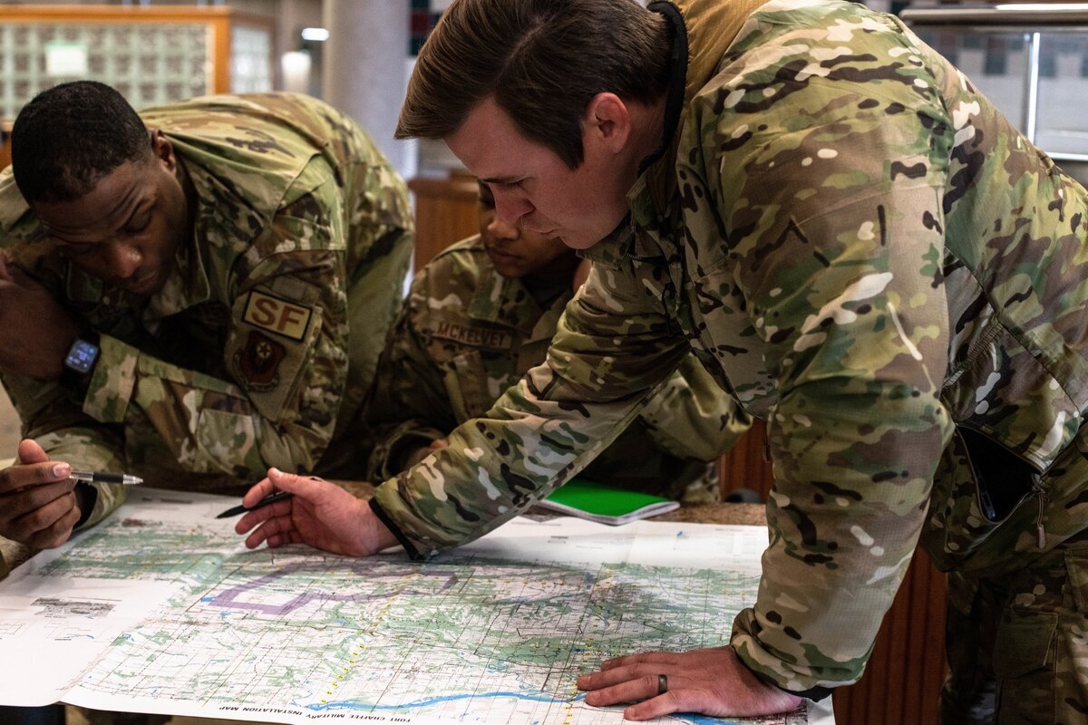
The students, from squadrons around the base, were divided into two teams and learned from four 137th CTF instructors throughout the week. The MST members worked with specialized equipment and learned how to read maps, find a grid coordinate, and use compasses to navigate over terrain.

“With this training we are taking a skill set we have built specifically for joint terminal attack controller qualification and are transferring that to the rest of the force,” said Maj. Jeffrey Hansen, 137th CTF director of operations. “Using our instructors’ teaching experience means we are more effectively tailoring the classes to the students, who range from tactical backgrounds like security forces members to technical backgrounds like civil engineers.”
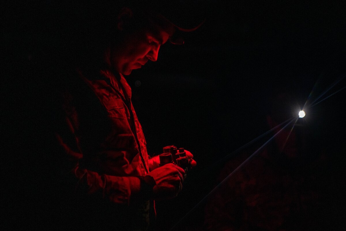
Learning skills outside of regular training will ensure long-term mission sustainment in austere locations, making Airmen more capable to operate in diverse deployed environments. 

“It was good going back to basics as far as land navigation, moving as a team with a weapon and pulling security,” said Tech. Sgt. Justin Davis, 137th CTF joint terminal attack controller (JTAC) qualification course manager. “These skills — for our Air Force specialty — are some of the first we learn because they are how we get to work. It was interesting finding the cutoff of what we needed to teach these students to help them understand basic land navigation and radio operation without getting into the weeds of the specific skills we instruct that help a JTAC drop bombs.”
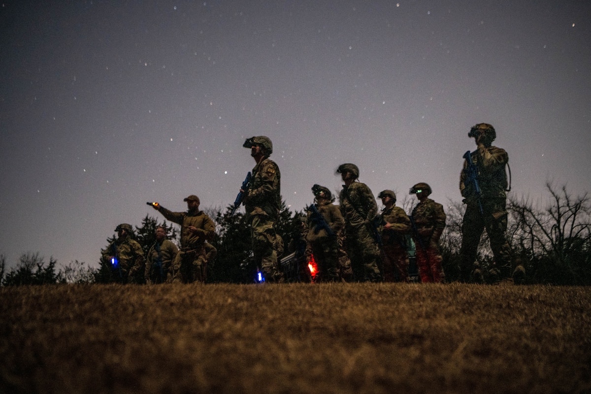
One day of training consisted of land navigation skill development in the field. Instructors set up points and gave students a grid location. Students then plotted a trail to find and report those points using maps, compasses and protractors. Once they reported their first checkpoint, the Airmen were given the location for the next one. 

“All of the skills we learned were brand new to me, so it was difficult to learn it all in the span of a week,” said Senior Airman Andrea Kuzilik, a services specialist with the 137th Special Operations Force Support Squadron. “The instructors were great, and super hands-on. It definitely got better the more we ran through it, and the field day really helped put everything together.” 
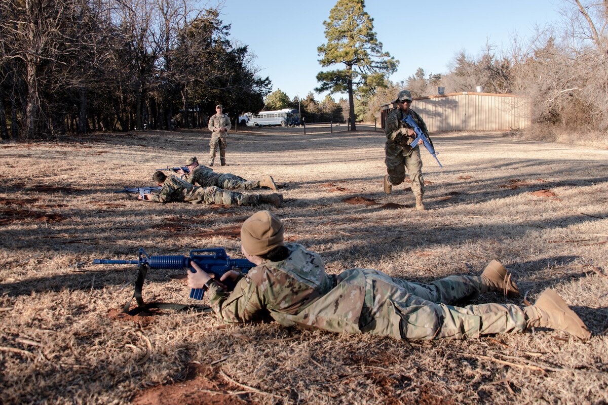
This exercise tested students’ radio programming and communication skills in addition to navigation. Students also learned how to move in a formation, react as a team to a direct contact with an adversary, and use night vision goggles to move in the dark and drive a Humvee.
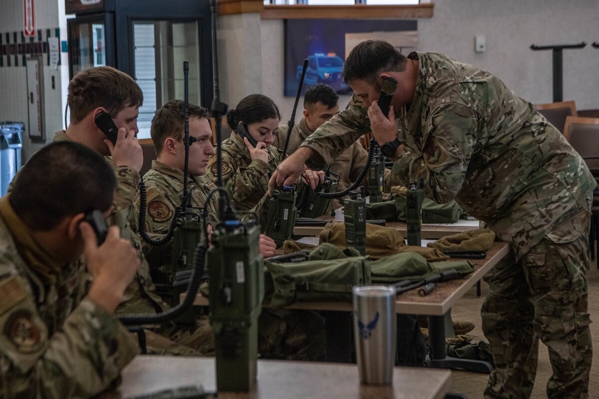
“It was good to see the different Air Force specialties come together for a common purpose during the training,” said Davis. “I think we as instructors are also excited to improve and streamline the course with each training iteration, especially because we saw a successful end result with this initial class using these skills in a practical setting versus a classroom setting.”

By TSgt Brigette Waltermire, 137th Special Operations Wing

Wndsn – Enhanced NATO-MIL Quadrant Telemeter and Field Manual

Tuesday, March 1st, 2022

No GPS? No problem. Electronic Countermeasures in effect? No problem.

“If you find yourself in a fair fight, you didn’t plan your mission properly.” –David Hackworth

Taking updates from the civilian-oriented High-Viz Quadrant Telemeter, Wndsn has released the latest version of their NATO-MIL Quadrant Telemeter.

Updates and Improvements

• A 150 MIL scale graded in 1 MIL increments (previously 130 MIL scale with 2 MIL increments)

• Removal of civilian features like the Obliquity Arc and the Shadow Square

• A MIL scale inside the degree arc graded in 25 and 100 MIL

• A dot grid inside the Quadrant allowing for more accurate string operations

• A coordinate scale for maps using a 1:25k scale to determine a position on a UTM grid by way of northing and easting.

Comes with manual.

store.wndsn.com/products/wndsn-pocket-quadrant-telemeter-nato-mil

OpEx 21 – True North Tradecraft

Monday, October 4th, 2021

I’ve followed True North Tradecraft for quite awhile on Instagram so it was a pleasure to finally meet Boris at Operator Expo.

True North Tradecraft teaches Personal Security Tradecraft from a Canadian Perspective and provides products to support that goal.

One of the items on their pretty sizable catalog is the OSS Lock Pick Set (Camp-X Canadian Custom Edition). For those of you unfamiliar, Camp X-ray was a training facility for the British Special Operations Executive and the SOE is who provided the American Office of Strategic Services with their initial training.

The kit consists of:

• Stainless & Spring Steel

• Tension Tool

• Razor Saw

• #3E Small Diamond

• #8 Short Hook

• #6E Euro Wave Jiggler

VSSL – Fire Striker Tin

Friday, September 24th, 2021

Known for their specialty tube-packed survival, first-aid, and outdoor living kits, VSSL has added a new twist, the Fire Striker Tin.

Packed in a twist off lid tin, the kit includes five waterproof Tinder Quick fire starting tabs, a Tethered Ferrocerium Rod and a Ceramic Striker in protective housing.

www.vsslgear.com/products/fire-striker

Exotac toolROLL

Sunday, October 18th, 2020

The Exotac toolROLL is an excellent choice to store and carry basic FieldCraft items like fire starters.

Once I rolled, it features a flap with five mesh pockets. Under that are five additional elastic slip pockets.

Blaze Orange so you won’t lose it when you need it most.

www.exotac.com/products/toolroll

WNDSN Range Calculator Dog Tag

Monday, September 21st, 2020

Berlin, 2020-09-17 – The best tool is the one that you always have on you, and the WNDSN MIL/MOA Range Calculator Dog Tag takes this saying literally. Upon customer request, WNDSN has developed a version of its popular MIL/MOA Range Calculator in the classic military dog tag format. This is the smallest usable range calculator, a tool that belongs on every explorer’s and marksman’s neck.

Designed for professional and recreational use, the MIL/MOA Range Calculator Dog Tag allows the user to input the MIL or MOA from their scope’s reticle and return the distance to the target of known dimension. This takes out the guesswork of gauging distance, enabling accurate range estimation and eliminating mental calculation errors while under stress.

The WNDSN MIL/MOA Range Calculator Dog Tag is made from black anodized aluminum according to U.S. standards for dog tags and weighs next to nothing. Like all WNDSN products, it features laser-engraved scales and includes instructional icons to create a self-contained tool. The backside is intentionally left blank, enabling the user to either sandwich the Range Calculator Dog Tag to the back of regular dog tags or to add additional information, velcro, or marker tabs.

“How far is my 3.5 mil, 12 inch target again?”

The Dog Tag’s scales are unitless, which means that the user can input MIL or MOA on the left side, and for the object size, if the value is in meters, input meters on the S-scale, and read the resulting distance meters on the D-scale. If the object size is in feet, feet is input and read as feet; to convert the result from feet to yards, the value is divided by 3. If the target size is in inches, the inner, left hand S-scale is used, which is graduated as 3 feet divided in 12 inches each. Inputting inches this way, the resulting value on the right hand D-scale is in feet.

For sub-degree angular sizes (1° = 60 minutes or MOA), the Dog Tag calculator provides increased precision by allowing direct input and calculation in MIL (milliradian) or MOA. The Dog Tag calculator can thus be used as a high distance/high precision companion to WNDSN Telemeters, it uses the same principles of calculating distance from angular size, only that with the Dog Tag calculator, the sighting and measurement isn’t done with the naked eye on the instrument but instead, the input values come from rangefinding reticles or similar devices.

Under certain conditions or in cases where laser rangefinders tend to fail or result in errors, WNDSN Telemeters prevail and can be used as primary or “second opinion” tools, to cross-check values obtained with different means, or in austere situations when other methods fail, are unavailable or contraindicated.

The device carries the WNDSN maker’s marks; usage instructions are engraved and supplemented by an included printed how-to booklet in both English and German. An 400-page printed comprehensive manual is available separately at WNDSN or via bookstores.

store.wndsn.com/products/wndsn-range-calculator-dogtag-3×3-aluminum

SIGMAN Camouflage SOP: A Guide to Reduce Physical Signature Under UAS

Wednesday, August 5th, 2020

Written by a group of US Marines, ‘SIGMAN Camouflage SOP: A Guide to Reduce Physical Signature Under UAS’ goes into great detail regarding signature management against Unmanned Aerial Systems.

The Marines have changed up their doctrine, adopting Littoral Operations in a Contested Environment (LOCE) and Expeditionary Advanced Base Operations (EABO), which require Fleet Marine Forces to support Navy sea control missions. This disperses small units along key littoral terrain. As you can imagine, our adversaries will be looking for them and one of the most effective means is via air, UAS in particular. Remaining hidden from these eyes in the sky isn’t just critical for mission success, but for survival.

Available for download from 2ndbn5thmar.com.

Introducing the Wndsn Telemeter Dog Tag Measuring Pendant

Thursday, February 27th, 2020

Wndsn Messtechnik is introducing the next tool in their line of distance measuring and range finding instruments. The latest one is another necklace based pendant, this time in the classic military dogtag format, making it the smallest usable Telemeter so far, a tool that belongs in every instructor’s and survival kit.

The Wndsn Dogtag Telemeter pendant is sized according to specifications and matches current U.S. dogtags. It is made from black anodized aluminum with laser-engraved scales and weighs next to nothing.

The Wndsn Dogtag Telemeter pendant fixates the distance to the measuring scale by way of creating a necklace that is holding the scales at a set distance from the eye, thus enabling accurate measurements. The simple instructions are, as always: “Find an object of known size at the distance you need to measure and determine the angular size which you can subsequently convert to distance.”

The new Wndsn Dogtag Telemeter pendant features two sets of scales; on the left-hand side, a standard angular size scale with a maximum of 10° graded in 0.2° increments, and on the right-hand side, a special multiplication scale that allows the user — knowing the dimension of the object to be measured — to directly multiply the value for the distance.

Further design elements and features are:

1. Both sets of scales have extra-long marks, extended from the edges to be visible with dogtag silencers installed.

2. The dogtag itself features instructional icons to create a self-contained tool.

3. The backside is intentionally left blank to either sandwich the Telemeter dogtag to the back of regular dogtags, or alternatively for the end user to add additional information, velcro, or marker tabs.

Wndsn Telemeters are wallet-size distance and altitude nomographs developed in the Wndsn applied science lab. They combine a thousand years of civil engineering, surveying, navigation, and astronomy in durable, low-tech, high utility instruments that can be brought anywhere, are self-containing, and independent of external, modern technologies.

Under certain conditions or in cases where laser rangefinders tend to fail or result in errors, Wndsn Telemeters prevail and can be used as primary or “second opinion” tools, to cross-check values obtained with different means, or in austere situations when other methods fail or are unavailable.

The Wndsn Dogtag Telemeter is made in Germany, its scales are laser-engraved and precision-cut into 1.5 mm black anodized, ultra-light aluminum. The device carries the Wndsn maker’s marks; scientific instructions are engraved and supplemented by a printed how-to in both English and German. An abridged manual is included as a PDF and a 240-page printed comprehensive manual is available separately at Wndsn or via bookstores.

The new Wndsn Dogtag Telemeter pendant is available at:

store.wndsn.com/products/wndsn-telemeter-dogtag-10×6-aluminum