FOR IMMEDIATE RELEASE: August 11, 2025
Huntsville, AL: GeoCue is proud to announce a new partnership with Geotronics Dystrybucja, one of Poland’s most experienced providers of geospatial solutions. Based in Kraków, Geotronics Dystrybucja officially joins the growing European distribution network for GeoCue, bringing TrueView 3D Imaging Sensorsand LP360 software to professionals across Poland.
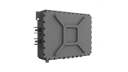
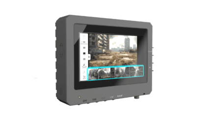
Now available through Geotronics, customers throughout Poland can access the full lineup of TrueView LiDAR solutions, including the all-new TrueView GO handheld mapping scanner. From drone LiDAR to mobile and SLAM-based handheld sensors, GeoCue’s products offer cutting-edge tools for collecting and processing accurate, colorized point clouds and geospatial deliverables.
Geotronics is also authorized to distribute LP360, GeoCue’sflagship LiDAR and photogrammetry software. LP360 enables users to extract information, run QA/QC workflows, and create high-quality mapping deliverables with ease in a familiar GIS interface.
With a legacy of over 30 years in the Polish geospatial market, Geotronics Dystrybucja has built its reputation on delivering high-quality surveying and positioning equipment, top-tier support, and trusted service as an authorized Trimble distributor. Their experienced team provides expert advice, warranty and post-warranty service, repairs, equipment rentals, and comprehensive geospatial training.
“We are excited to represent GeoCue in Poland and provide our customers with access to some of the best LiDAR technology available, including the TrueView GO handheld scanner where we already see unique interest,” said Tomasz Zieli?ski, Commercial Director at Geotronics Dystrybucja. “GeoCue’sLiDAR surveying and mapping solutions fit perfectly within our portfolio and will help us continue delivering excellent service and superior products for our customers.”
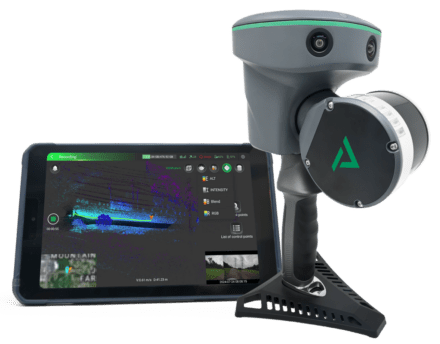
Geotronics Dystrybucja now offers the TrueView GO handheld LiDAR scanner
As GeoCue continues to expand its reach across Europe, the company is pleased to welcome Geotronics Dystrybucja.
Samuel Flick, European Sales Manager for GeoCue, added, “We’re very grateful to connect with the team at Geotronics and continue growing our presence in Europe. This is a trusted and experienced distributor that shares our commitment to service and innovation. They can expect unparalleled support from everyone at GeoCue to help make this partnership a success.”
With this collaboration, customers in Poland can now explore a more complete set of geospatial tools, from high-performance LiDAR sensors to powerful processing software, backed by the combined support of two experienced teams in GeoCue and Geotronics Dystrybucja.