Easily and Quickly Capture Reality While You Walk.FOR IMMEDIATE RELEASE: July 29, 2024
Huntsville, AL – GeoCue, a leader in geospatial solutions, proudly announces the addition of the TrueView GO to its innovative product lineup, which includes TrueView drone and mobile mapping systems as well as LP360 3D point cloud software. This latest release marks GeoCue’s entry into the handheld mapping arena, setting a new standard for portable, high-precision geospatial data collection.
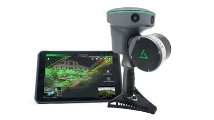
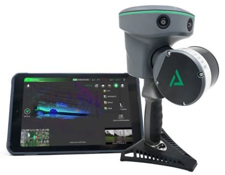
The TrueView GO is the ultimate handheld mapping system designed for effortless reality capture and detailed 3D mapping. Its intuitive operation simplifies the process to “Ready, set, GO!”- making professional-grade scanning as easy as walking.
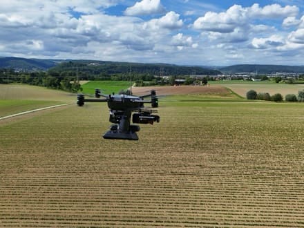
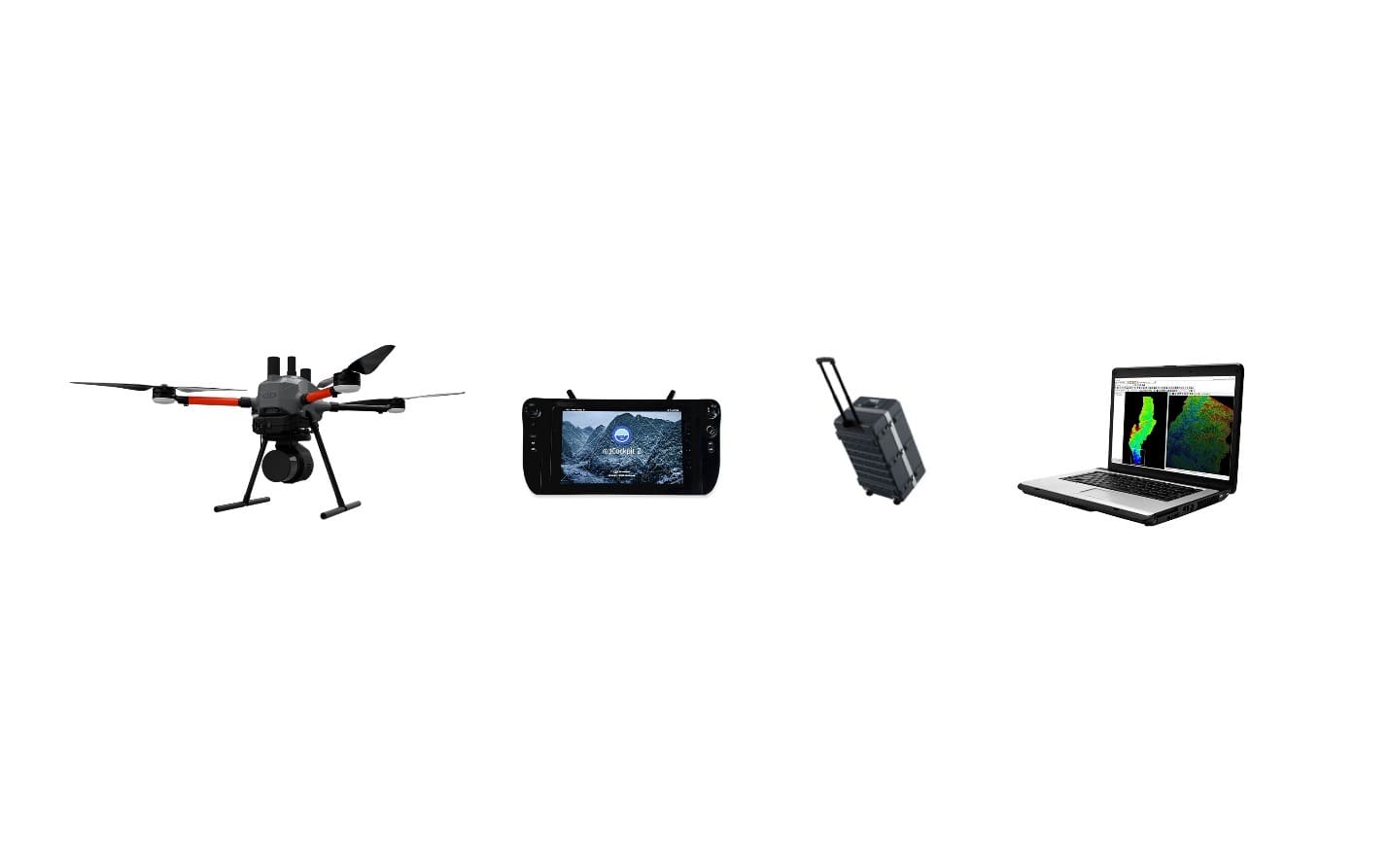
The TrueView GO series, featuring the 16-channel 116S and the 32-channel 132S models, integrates cutting-edge GNSS RTK, survey grade LiDAR scanning, cameras and visual SLAM technologies. These features enable users to effortlessly generate digital twins in real-time as they walk, capturing both indoor and outdoor environments with unprecedented ease and speed.
“Launching the TrueView GO, is logically the next step in growing our product offering,” said Frank Darmayan, CEO of GeoCue. “We now give you every option to collect data and make informed decisions about your projects: from the air, on the road, and now by simply walking with our handheld scanner.”
The TrueView GO is the ultimate handheld mapping system designed for effortless reality capture and detailed 3D mapping. Its intuitive operation simplifies the process to “Ready, set, GO!”- making professional-grade scanning as easy as walking.
Key Features of the TrueView GO Include:
GNSS RTK and SLAM Fusion: Ensures superior mapping accuracy with a state-of-the-art GNSS Smart Antenna and high-precision LiDAR.
Real-Time SLAM Capabilities: The TrueView GO scanner produces real-time georeferenced point clouds displayed live on the tablet, allowing for instant adjustments and ensuring thorough coverage.
Operate with Weak or No GNSS: TrueView GO uses LiDAR and Visual SLAM to achieve superior results, even in areas without satellite signals, ideal for indoor and urban surveys.
Remote Measurement: The technology has the capability to scan inaccessible areas by collecting reference points without being on the exact point.
Loop-Free Path Planning With RTK: TrueView GO’s SLAM technology eliminates the need for traditional loop closure and overlap, reducing the time and distance required for project completion by allowing flexible, efficient path planning when you have GNSS coverage.
What sets the TrueView GO apart from other handheld mapping scanners is not just the scanner itself but also the powerful new software accompanying it—LP360 LAND. This custom-tailored geospatial software is specifically designed for processing handheld LiDAR and imagery data.
LP360 LAND enhances data accuracy with robust QA/QC tools, 3D point cloud processing and visualization, and featurescapabilities such as SLAM, denoising, colorization, registrationand classification. Leveraging both desktop and cloud environments, LP360 LAND efficiently handles diverse applications like data classification, tree segmentation, volume calculation, and export to BIM, delivering quick and seamless results.
“Our software is pivotal as it allows users to not only create detailed point clouds from raw data but also to carry out quality control on the LiDAR and image data collected,” said Vivien Heriard-Dubreuil, CEO of GeoCue parent company mdGroup. “Furthermore, the integration of LP360 LAND with TrueView GO enhances our workflow tremendously, offering the ability to effortlessly process, combine and integrate data from varied sources such as drones, mobile units, and terrestrial scans.”
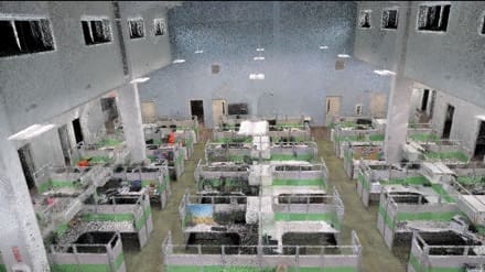
The TrueView GO handheld mapping scanner helps to combine various data sets, enabling the creation of a digital twin of any project. The result is a dense, precise, and highly accurate As-built environment of your entire project.
GeoCue’s TrueView GO is designed for professionals across various industries, including surveying, civil engineering, construction, urban planning and forestry, providing them with the tools they need to collect detailed and accurate data efficiently.
“The TrueView GO represents a significant expansion of our addressable market beyond traditional drone LiDAR systems due to its accessibility, affordability, and ease of use,” explained Vincent Legrand, Vice President of Global Sales.
“This device is versatile enough to be used in a wide array of environments and applications, from indoor settings to expansive outdoor areas. Perfect for fields such as forensic crime scene investigations, historic building preservation, facility digitalization, and Scan to BIM processes. Essentially, if you can walk through your project, you can utilize the TrueViewGO. This adaptability opens up countless possibilities for professionals across various industries, ensuring that advanced mapping technology is now within reach of many more users.”
The TrueView GO is now available for pre-orders, packaged with the powerful LP360 LAND processing software, allowing users to process, combine, and fuse collected data with unparalleled ease.
To learn more about GeoCue, visit www.geocue.com.