FOOTPRINT from RAFAEL Advanced Defense Systems Ltd is a navigation system for dismounted soldiers operating in GPS-denied environments.
The system fuses data from multiple sensors like the one seen mounted to Soldier’s leg above to analyze movements, estimate errors, and provide a highly accurate, and continuous RT self-positioning.
L3Harris’ leading-edge mission solutions were on full display at Exercise Steel Knight 20.
Recent field demonstrations provided the U.S. Marine Corps with an up-close perspective on the robust capabilities of the AN/PRC-117G Multiband Networking Manpack radio featuring the Mobile User Objective System (MUOS) Satellite Communications waveform.
Recently, the Marines evaluated MUOS and the software-upgraded AN/PRC-117G during a series of exercises at Steel Knight 20. There, the warfighters from the 1st Marine Division conducted a series of scenarios across multiple training sites in California and Arizona designed to simulate operations against peer and high-capability adversaries.
“Adding this capability to the 117G enables the Marines to leverage the proven radios they have already deployed, fought and trained with to access the advanced capabilities and capacity of the MUOS satellites with a simple software upgrade,” Dana Mehnert, president of L3Harris Communication Systems, said. “The MUOS upgrade also enables interoperability with other U.S. DOD and allied users who deploy this advanced capability.”
Exercise Steel Knight 20 included the longest-range raid exercise in 14 years. It included 29 aircraft that transported ground troops from Marine Corps Air Station Camp Pendleton, California, to a simulated combat zone in Yuma, Arizona. Transmitting and receiving near-real-time updates during the long-range movement to the objective, the raid force commander was able to adjust and plan his raid based on any changes. The Beyond-Line-Of-Site (BLOS) and On-The-Move (OTM) capability offered by the AN/PRC-117G and MUOS led to a successful raid on the objective and met the commander’s intent for digital interoperability and Command-and-Control On-The-Move.
Scenarios, which were designed to demonstrate Command-and-Control (C2) connectivity throughout entire mission threads, saw MUOS employed throughout simulated congested and contested battlespaces. AN/PRC-117Gs were operated by dismounted Marine Rifle Squads in addition to being integrated on board a variety of Marine-specific platforms, including MV-22 Osprey Tilt-Rotor air frames, HMMWVs, and Light Armored Vehicles – the latter of which were used to support amphibious assault operations.
The exercise followed seven months in which U.S. Marine Corps Systems Command conducted a series of end-user evaluations designed to assess the latest version of the MUOS SATCOM system.
THE GAME-CHANGER
MUOS’ robust quality on the L3Harris terminals allows warfighters to communicate seamlessly when on the move, without needing to stop the mission to point antennas to regain communications, according to Marty LoBiondo, L3Harris’ product line management waveform director.
“It allows users to stay connected even in sub-optimal conditions,” he said. “MUOS provides the warfighter with significantly enhanced capabilities that enable new tactics, techniques and procedures for communication Beyond-Line-Of-Sight.”
Further, MUOS has allowed M777 and HIMARS artillery assets to coordinate fires from longer distances with fewer assets, Robert Brown, L3Harris’ lead sales engineer for Communication Systems, said.
Brown also highlighted the significant increase of MUOS in the Air Combat Element C2 community.
The MUOS terminal is much less burdensome on Marines than legacy SATCOM systems, Jeff Wrobel, L3Harris director of Navy and Marine Corps Business, said of the system’s operational advantages.
“Once you program and turn it on, you’re pretty much ready to go,” he said.
The Marine Corps is expected to operate the MUOS waveform as it replaces legacy narrowband SATCOM capabilities. Designed to ship data from the tactical “edge” across the battlespace, MUOS relies upon a network of satellites in Geosynchronous Earth Orbit (GEO).
AN/PRC-117G UPGRADES
Upgrades to the AN/PRC-117G have enabled the Marine Corps to ensure an “easy MUOS upgrade across the Corps without recapitalizing its entire installed base of radio systems,” Wrobel said.
L3Harris has also designed three new antennas for operations on the AN/PRC-117G to support the upgraded MUOS waveform.
These omni-directional antennas provide end users with OTM communications. They eliminate the need for users to “pan and tilt” antennas to align with any of the multiple MUOS satellites.
The upgraded AN/PRC-117Gs had been optimized to support the MUOS waveform in extreme latitudes. Historically, armed forces have struggled to maintain Line-Of-Sight connectivity to GEO satellites in these areas.
Additional operational benefits of the upgraded MUOS waveform over legacy SATCOM systems include enhanced voice quality and data support.
LOOKING FORWARD – NOW
The Marine Corps is focused on MUOS support of Marine Expeditionary Units (MEUs) in addition to naval vessels, according to Brown.
“The Marine Expeditionary Force has been doing a lot of work with the MEUs recently to integrate the MUOS capability aboard the Amphibious Readiness Group ships,” he said.
The AN/PRC-117G and AN/PRC-158 MUOS software upgrade provides the Marines with a greater number of SATCOM users, enhanced voice and data communication, as well as robustness in disadvantaged environments where they operate, such as urban and high/low latitude locations.
MEET MUOS
The Mobile User Objective System, MUOS, is the U.S. Defense Department’s next-generation Ultra HF tactical satellite communications network. MUOS provides worldwide, BLOS voice and IP connectivity to the DOD Information Network (DODIN) via SIPR/NIPRnet. The MUOS network provides warfighters with unprecedented access to MILSATCOM channels with robust connectivity, increased mobility and enhanced security. Overall, these capabilities provide the ability for MUOS-capable terminals to communicate in underserved and disadvantaged environments connecting to the DODIN anywhere in the world.
Posted in Comms, MDM, Press Release | Comments Off on L3Harris – AN/PRC-117G Multiband Networking Manpack radio featuring the Mobile User Objective System
Berlin, 2020-09-17 – The best tool is the one that you always have on you, and the WNDSN MIL/MOA Range Calculator Dog Tag takes this saying literally. Upon customer request, WNDSN has developed a version of its popular MIL/MOA Range Calculator in the classic military dog tag format. This is the smallest usable range calculator, a tool that belongs on every explorer’s and marksman’s neck.
Designed for professional and recreational use, the MIL/MOA Range Calculator Dog Tag allows the user to input the MIL or MOA from their scope’s reticle and return the distance to the target of known dimension. This takes out the guesswork of gauging distance, enabling accurate range estimation and eliminating mental calculation errors while under stress.
The WNDSN MIL/MOA Range Calculator Dog Tag is made from black anodized aluminum according to U.S. standards for dog tags and weighs next to nothing. Like all WNDSN products, it features laser-engraved scales and includes instructional icons to create a self-contained tool. The backside is intentionally left blank, enabling the user to either sandwich the Range Calculator Dog Tag to the back of regular dog tags or to add additional information, velcro, or marker tabs.
“How far is my 3.5 mil, 12 inch target again?”
The Dog Tag’s scales are unitless, which means that the user can input MIL or MOA on the left side, and for the object size, if the value is in meters, input meters on the S-scale, and read the resulting distance meters on the D-scale. If the object size is in feet, feet is input and read as feet; to convert the result from feet to yards, the value is divided by 3. If the target size is in inches, the inner, left hand S-scale is used, which is graduated as 3 feet divided in 12 inches each. Inputting inches this way, the resulting value on the right hand D-scale is in feet.
For sub-degree angular sizes (1° = 60 minutes or MOA), the Dog Tag calculator provides increased precision by allowing direct input and calculation in MIL (milliradian) or MOA. The Dog Tag calculator can thus be used as a high distance/high precision companion to WNDSN Telemeters, it uses the same principles of calculating distance from angular size, only that with the Dog Tag calculator, the sighting and measurement isn’t done with the naked eye on the instrument but instead, the input values come from rangefinding reticles or similar devices.
Under certain conditions or in cases where laser rangefinders tend to fail or result in errors, WNDSN Telemeters prevail and can be used as primary or “second opinion” tools, to cross-check values obtained with different means, or in austere situations when other methods fail, are unavailable or contraindicated.
The device carries the WNDSN maker’s marks; usage instructions are engraved and supplemented by an included printed how-to booklet in both English and German. An 400-page printed comprehensive manual is available separately at WNDSN or via bookstores.
The warfighter’s interface to the networked battlefield
New York, NY. – Persistent Systems, LLC (“Persistent”) announced today that it has unveiled the new Rugged Display and Controller (RDC) for the MPU5 mobile ad hoc networking (MANET) device. An alternative to third-party consumer Android™ phones used with the MPU5, Persistent’s purpose built RDC offers improved ruggedness, ergonomics, and enterprise-class management in one of the few Android™ End User Devices (EUD) made in America.
“When you plug in the RDC, you instantly have a complete situational awareness capability,” said Brian Soles, Persistent’s Vice President of Business Development. “The MPU5 is a computer that runs the Android™ operating system, and every MPU5 comes preinstalled with the Tactical Assault Kit (TAK), which is a full-fledged situational awareness Android™ app.”
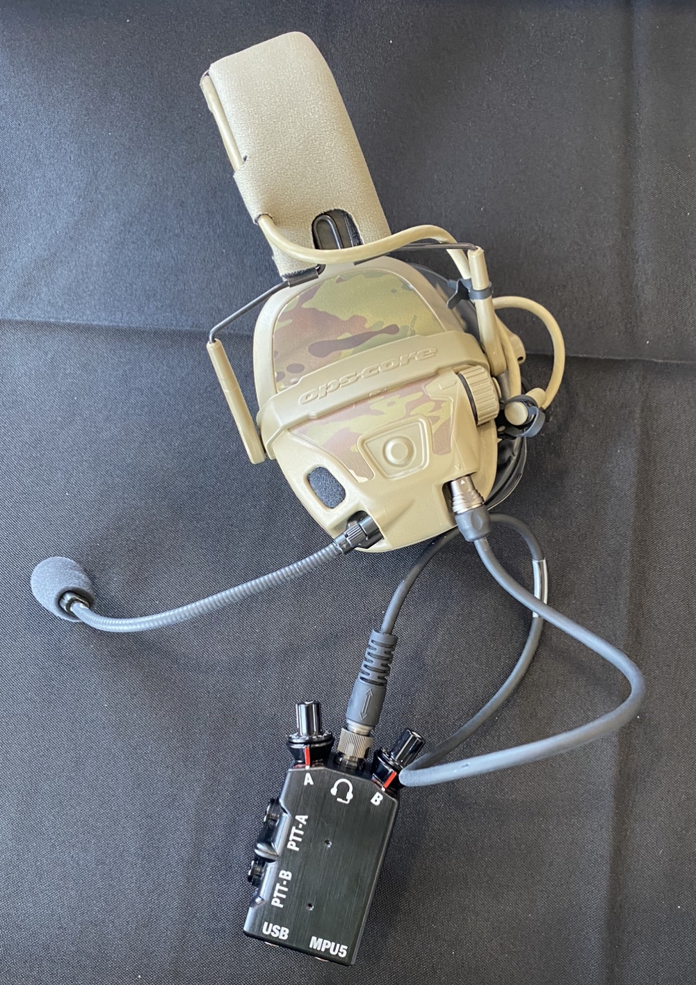
The RDC’s 5.7-inch multi-touch screen, combined with the Dual PTT and MPU5, comprise a complete kit for the tactical operator, allowing that operator to receive voice, video, and situational awareness data directly from every user, unmanned systems, and sensor on the network.
Designed for tactical users who wear gloves, the RDC has physical buttons for ease and speed of use, including the Android™ standard Home, Back, and App Overview buttons. When connected, the RDC appears to Android™ as a Gamepad Input Device, with two (2) joysticks, rocker-switches, A-B-X-Y buttons, and an emulated D-Pad. Tactical users can now navigate their applications faster, using joysticks to zoom in and hotkeys to quickly switch between functions.
Eight integrated high-precision sensors (accelerometer, gyroscope, magnetometer, thermometer, pressure, light sensors, and rear-facing camera) feed data into the Android™ Sensor Framework, enabling applications to incorporate motion, orientation, and environmental data.
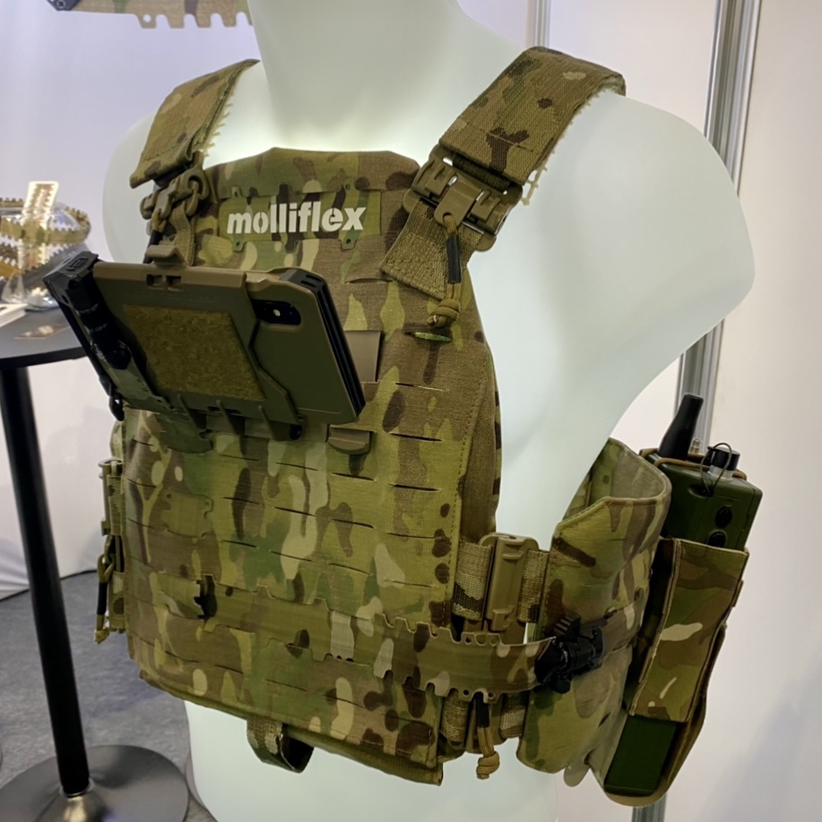
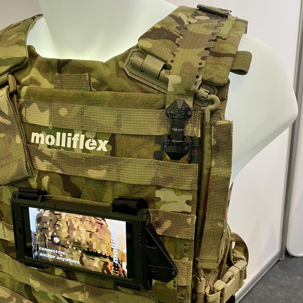
“We designed the RDC to match the chest-worn formfactor that users were already accustomed to with commercial EUDs, while delivering increased ruggedness and capability,” Soles added. “We contracted Juggernaut.Case to design the chest mount, to provide a unified experience to the end-user.”
Wave Relay® Ecosystem partners and third parties have developed Android™ applications to drive unmanned ground robots, fly unmanned aerial vehicles, and steer EO/IR cameras. The RDC helps achieve Persistent’s vision to deliver those capabilities to every soldier through the networked battlefield.
ONTARIO, California – Safariland®, a brand of The Safariland Group, a leading global provider of safety products designed for the public safety, military, professional and outdoor markets, announced today that it is expanding its Impulse Hearing Protection line. The new Foam Impulse Hearing Protection blocks damaging noise while allowing conversation and other ambient sounds in—without the need for expensive electronics.
“I’m amazed how well they knock down noise levels,” stated Rob Leatham, professional competition shooter. “It’s a real game-changer in the fact that I can leave the Foam Impulse earbuds in my ears at all times to protect my hearing, but still hear what’s happening around me. You can’t do that with regular, passive earplugs or earmuffs!”
Safariland’s Foam Impulse Hearing Protection earbuds ($14.99 MSRP) reduce dangerous sound levels by up to 38dB and offer 13dB of continuous sound reduction, all while allowing speech and audio to be heard. The patent-pending Impulse sound filters instantly block large sound waves, while permitting smaller speech and audio waves to pass into the ear.
The Foam Impulse ear buds are washable and won’t interfere with eye protection, shouldering long guns, or impede physical activity. Foam Impulse earbuds are ideal for all-day wear alone or under a traditional headset.
Features:
• Instantly reduces dangerous sound levels while allowing speech and audio to be heard
• Impulse Mode = 38db Peak Impulse Reduction + 13db Continuous Reduction
• Full-Block Mode = 20db Continuous Reduction
• Universal-fit, memory foam tips
• Removable neck cord
• No batteries required
• Ideal for the shooting range, hunting, tactical training or operational missions
Atlantic Signal has been awarded its second consecutive multi-year contract to supply tactical communication equipment to both the FBI Special Operations Units (SOU) around the country as well as the Hostage Rescue Team (HRT) located in Virginia.
Having been awarded its initial nationwide FBI tactical communications contract in 2015, Atlantic Signal was challenged in 2019 with developing the next generation of tactical communications to meet a very different set of expectations.
To address an ever-changing radio landscape, the company developed a new multi-application, programmable push-to-talk that can be set up and customized for each individual operator’s specific preferences. The PTT, known as ‘THE SHIELD Push-to-Talk’, allows the Bureau to operate multiple radio platforms, ICS systems, smart phones, chat programs along with cross- banding capabilities. Additionally, custom plug and play cable accessories were designed for ‘THE SHIELD PTT’ systems.
In an effort to save the Bureau key financial resources, the Bureau-specific ‘SHIELD PTT’ model was designed to be compatible with Atlantic Signal radio and accessory cables already being used in the field from the previous 5 year contract purchases.
In addition to ‘THE SHIELD PTT’, Atlantic Signal co-developed an in-the-ear communication system known simply as ‘THE SHIELD’. While other two-way radio, in-the-ear, tactical communication systems utilize transmit microphones in the ear that pass TX via a bone or air microphone located inside the ear, it was Atlantic Signal’s desire to provide a system that utilized a micro-thin, yet robust, noise canceling boom microphone that could be positioned on either the right or left side of user’s face. Further, rather than use high-priced, multiple sized, regularly replaced ear tips, Atlantic Signal is providing custom earmolds for every operator with a secondary back up included as well. This allows for an individualized custom fit with little to no ear fatigue or dislodging issues. While ‘THE SHIELD’ was designed to also allow for multi-sized, disposable ear tips, the Bureau chose the custom earmold model recommended by Atlantic Signal.
The ‘SHIELD PTT’ was designed to allow the Bureau to ‘launch’ multiple comms systems from a single PTT model – thus, in addition to ‘THE SHIELD’ in-the-ear communication system, the Bureau selected Atlantic Signal’s 3M/Peltor exclusive ComTac VI headset featuring the all new NIB feature. The ComTac VI offers a new way to adjust the auditory settings of the headset for each mission. Traditionally, a headset has a set frequency response, and the operator can only increase or decrease the volume. The MAP function provides new advanced ambient listening modes that allow access to a variety of gain settings, but with frequency shaping, to enhance auditory performance in five conditions. The MAP Profiles have been designed with a variety of combat and combat support operations in mind.
NIB enables short-range, headset-to-headset communication in high noise environments, without the use of an external communications radio. The NIB function allows for 4 team members to speak simultaneously, and over 60 people, within a 10 – meter radius, to listen at any given time. Audio transmit is activated by either a voice activated switch (VOX) for hands free operations or by push-to-talk. The VOX switch is adaptive, meaning the threshold to activate will adjust automatically to the noise environment. To help reduce user burden, a tactile button has been added to the left ear cup that allows the user to easily turn on or off the function / and switch from VOX to PTT settings. The Bureau tested the ComTac VI extensively before choosing as there was a strong desire to utilize the NIB technology / capability as a wireless intercom – avoiding the expense and installation of additional hardware albeit it hardwired in a vehicle or aircraft or provided as a mounted/dismounted portable solution. The Bureau also selected the company’s wireless, gun mounted push-to-talk, Lo Vis R23 single and dual ear patrol kits and wired HAHO switch.
“It is an honor for our company to continue to provide two of America’s elite tactical units communications equipment that meets their most stringent requirements. We began this relationship in the early 2010s when the Bureau’s previous supplier simply failed them. We spent nearly two years fine-tuning a multi-comms solution for them back then which resulted in a 5-year nationwide contract being awarded to our company in 2015. We are honored to receive our second consecutive 5-year contract after once again facing considerable competition during the selection phase,” stated Randall Hedrick, President and Managing General Member of Atlantic Signal.
Atlantic Signal is based out of Topeka, KS where they develop, design, manufacture and sell tactical communications and accessories. The company started in 1989 with a focus on tactical law enforcement. Today the company’s clients include NYPD ESU, LAPD, ATF, USMS, CBP, NSW, MARSOC, USCG and the FBI among thousands of military and law enforcement clients around the world.
Posted in Advertiser, Comms, Contracts, Press Release | Comments Off on ATLANTIC SIGNAL Receives Second Consecutive Multi-Year / Multi-Million Dollar Nationwide FBI Tactical Communications Contract for Special Operations Units and Hostage Rescue Team
In 1959, the Navy built the first real satellite navigation system, which was called TRANSIT. The system was designed to locate submarines and started out with six satellites and eventually grew to ten. The subs often had to wait hours to receive signals from the satellites, but the model set the stage for accurate GPS with continuous signaling from satellites in space. The GPS project was launched in the United States by the Military in 1973 to overcome previous navigation systems’ limitations, integrating ideas from several predecessors, including classified engineering design studies from the 1960s.
In 1983 shortly after the Russians shot down Korean Air flight 007 after it wandered off course into Soviet airspace over the Kamchatka Peninsula, president Reagan offered to let all civilian commercial aircraft use the GPS (once it was completed) to improve navigation and air safety.
The original system used 24 satellites. It was initially developed for use by the United States military and became fully operational in 1995. When I first joined the Military in the late ’80s, the first GPS I used was the AN/PSN-8; you had to put it on an Alice pack frame and carry it by itself like it was a radio. Because it basically was the size of one. We would use a cargo strap to secure it to the back of the bolster seats on the RHIBS. It was used until after the 1st Gulf War. Later it was replaced by the AN/PSN-11 Precision Lightweight GPS Receiver (PLGR, “plugger”) that was used during the invasion of Somalia.
The network now consists of about 30 satellites orbiting the Earth at an altitude of 20,000 km. Not all 30 are in use; some are set aside as spears.
Since 1993, the US Air Force has made its Global Positioning System (GPS) available to the world, and ever since then, that technology has found its way into our everyday lives. Once it has information on how far away at least three to four satellites are, your GPS receiver can pinpoint your location thru trilateration (it also uses cell towers if close enough). The system is made up of three parts: satellites, ground stations, and receivers. Satellites act like the stars in constellations—we know where they are supposed to be at any given time. The ground stations use radar to make sure that you are where you think you are. The receiver is continuously listening for a signal from satellites. Just about everything, today can tell you your position on the Earth from your phone to your watch and dive computers.
I remember when the first GPS watches came out, you had to make sure it had a clear view of the sky. You would also have to make sure the older military GPS’s had the most updated crypto in them, or it didn’t work and had to carry dead weight with you. Today there are a lot of options for handheld or even dive mask mounted. The SCUBAPRO Galileo HUD Pro can hold up to 31 GPS waypoints and a full dive computer. It will give you a compass heading, tell you the time and distance to your target. The one bad thing about all the civilian GPS is if there ever is a full out war, they will be the first things turned off. So, don’t forget the basics of time, speed, and distance.
With two new satellites in orbit and eight more in various stages of development, the latest, GPS III, is already being built. The next generation of GPS should go fully operational around 2023.
The first GPS III satellite launched by Lockheed Martin cost an estimated $529 million to build. The satellite’s outstanding longevity will offset some of this upfront cost. Unlike the early GPS satellites, which have a design life of 7.5 years, the new GPS III satellites will last 15 years — twice as long as the oldest satellites in orbit and 25 percent longer than the latest satellites in the GPS fleet. The new GPS III satellite system is designed to adapt to new technology, and its mission objectives change. The next generation of GPS will be up to 3 times more accurate than existing GPS technology. That means the 5 to 10-meter accuracy you see now with current GPS technology will be more like 1 to 3 meters.
With all these improvements aimed at the civilian side of things, it’s easy to forget that GPS is first and foremost a military technology. There will be new command centers capable of controlling the existing GPS satellite and the new GPS III satellites from the ground. The next generation of GPS is expected to be available by 2022-2023.
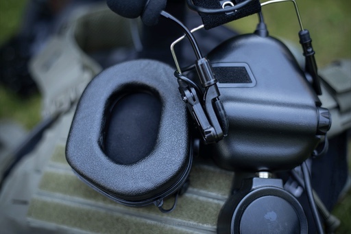
This is the Raptor Tactical Peltor Ear Pro Wrap paired with Koffin Wurks’ Krypt.
The Peltor Ear Pro Wrap features an air mesh liner to keep you cool and comfortable all day on the range along with a top loop for name badge, carabiner loop on the backside and low profile PALS panel for cord management.
Offered in MultiCam, Coyote, Black, and Ranger Green with others in stock occasionally. Check the website to see what’s available.
Or stop by the shop
704B Festus Ave
Fayetteville, NC 28303
The Coffin Wurks Krypt is a means to manage the down leads on popular ear protection/headsets like Peltor Comtacs and MSA Sordins. They are handmade from military spec materials and easily attach to the headset with industrial strength hook and loop.