Colt

Archive for the ‘ISR’ Category

ADS Showcases Updates To Hydroid REMUS 600 Unmanned Underwater Vehicle

Wednesday, February 5th, 2020

In the past, Hydroid’s REMUS Underwater Vehicle would complete its mission and it would take 10 hours or more to download the datasets. With the addition of the new HISAS 2040 Module, the data is processed during the mission, so users get high-def images in near real time. Here is the ADS press release.

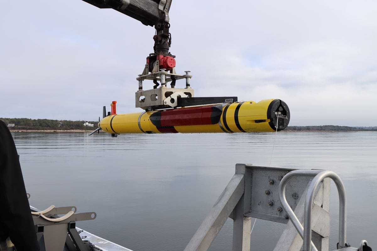
Hydroid Integrates HISAS 2040 Module with In-Mission Processor onto a REMUS 600 Unmanned Underwater Vehicle.

The in-mission processor (pictured in red) allows real-time processing of HISAS data, giving operators the ability to download high-resolution images immediately when the vehicle returns from its mission.

Unmanned underwater vehicles (UUVs) play a crucial role within the defense space with their ability to carry out unique missions. UUVs provide many advantages to the fleet with their autonomy and long endurance, making missions safer and easier to accomplish. Their modularity allows for them to be outfitted with different payloads for varying mission requirements.

REMUS 600 UUV applications include:

·         Mine Countermeasure Operations

·         Hydrographic Surveys

·         Search & Salvage Operations

·         Marine Research

·         Environmental Monitoring

·         Debris Field Mapping

View Product Details

The REMUS 600 UUV from Hydroid, Inc. is positively buoyant and is designed to operate to depths of 600 meters. With mission duration capability of up to 24 hours, the REMUS 600 delivers unprecedented endurance. Sonar technology is used on these UUVs to capture images for organic mine countermeasure, hydrographic surveys, area searches, and surveillance and reconnaissance.

HISAS 2040 provides up to 2cm by 2cm resolution across a 300-meter swath. Synthetic aperture sonar uses algorithms to synthetically lengthen the aperture, providing consistent resolution across the entire swath, both along and across track, as opposed to traditional real aperture side scan sonars. Because of the high resolution of HISAS, the files are very large and can take several hours to download after a mission is complete.

To help solve this problem, Hydroid, Inc. integrated an in-mission processor on a REMUS 600 Unmanned Underwater Vehicle (UUV) with the KONGSBERG High-Resolution Interferometric Synthetic Aperture Sonar (HISAS) 2040.

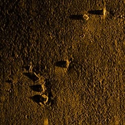
Pictured: High-resolution Interferometric Synthetic Aperture Sonar (HISAS) 2040 images from a REMUS 600 Unmanned Underwater Vehicle

With the in-mission processor, HISAS data is processed and compressed in real-time along with the navigation data, allowing immediate download of the sonar imagery when the vehicle returns from its mission through a 10GB Ethernet switch. This is ideal for time-sensitive missions like mine countermeasures, where faster data access means safer, more efficient operations. Other HISAS applications include hydrographic surveys, pipeline inspection and rapid environmental assessment.
Learn more about Hydroid’s core capabilities »

Nellis Threat Training Facility

Saturday, February 1st, 2020

SSD Reader and fellow AFSOC Veteran MSgt Steve Venski (USAF, Ret) sent us this write up of his recent visit to the Nellis Threat Training Facility, or as commonly known the “Petting Zoo” near Las Vegas. He thought other readers would be interested as well. We agree.

Deserts rarely give up their secrets willingly. And the deserts of Nevada are no exception. Outside of Las Vegas, off to the northwest, lies the Nevada National Security Site; euphemistically known as N2S2. Covering almost 1400 square miles of Nevada, there are legends and secrets galore. However, much closer to Sin City, is Nellis Air Force Base, home to U.S. Air Force Fighter Weapons School. The most widely known exercise, is RED FLAG. While the movie TOP GUN has received much press and movies made, the fact is, the U.S. Air Force (USAF) trains all branches of the service (except the Coast Guard; still haven’t figured out how to make those boats fly…) in what’s termed ACM; Air Combat Maneuvering, dogfighting. The airspace of RED FLAG, lies within what’s known as the Nevada Test and Training Range (NTTR); over 5,000 square miles of Nevada. Get your head around that one.
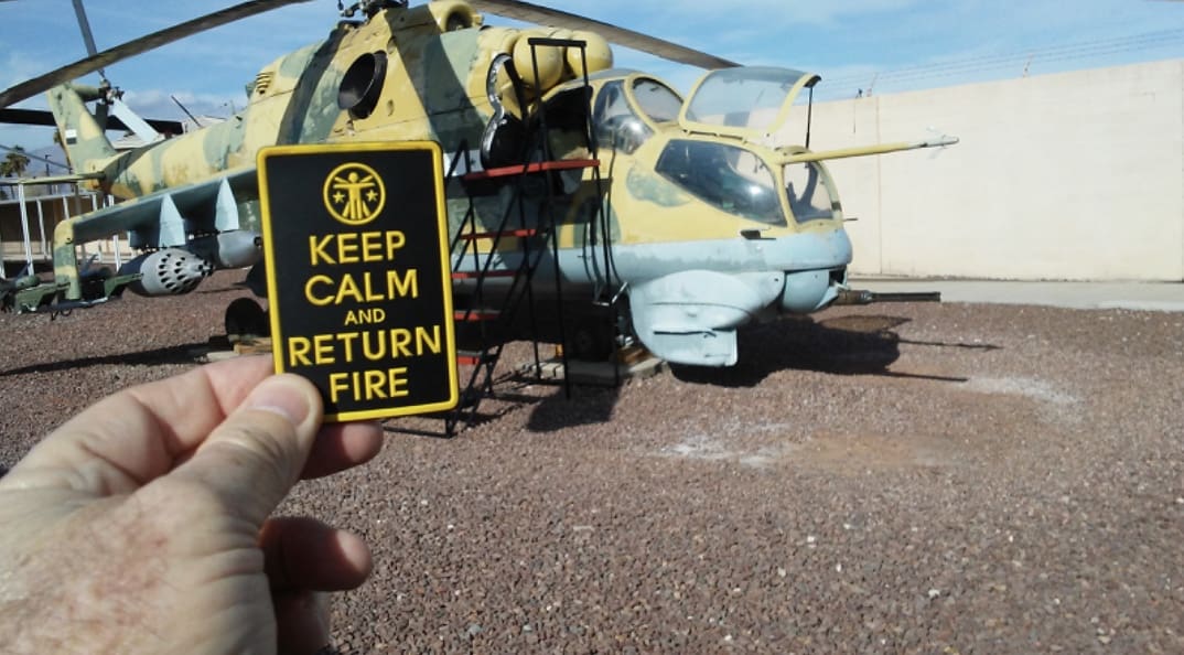
Towards that end, realistic training is essential. Our adversaries don’t fly the same gear we do. Over the decades, the U.S. has acquired (by hook or by crook), quite a few airframes of what the bad guys would be flying. There exists a formerly classified facility on Nellis Air Force Base, known as the Threat Training Facility. Many years ago, I visited this place, and it took a full-on security clearance to gain admission.
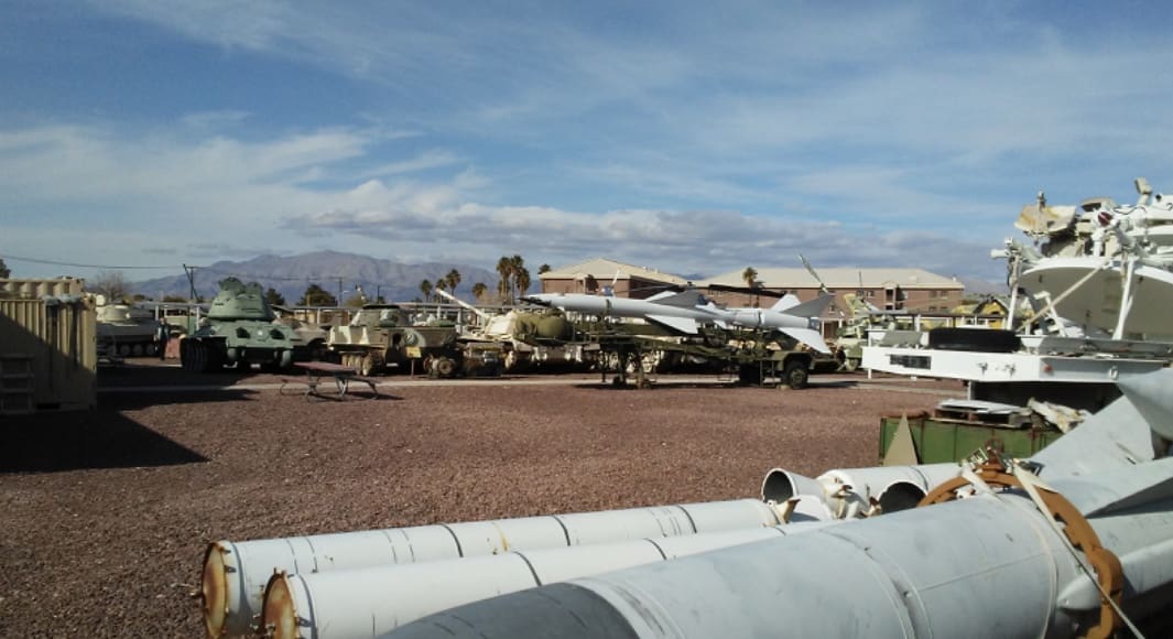
Fast-Forward 20 years….the proliferation of weapons by countries hostile to the U.S., has resulted in explosive growth of the TTF, and a re-thinking of who needs to know about these weapons systems, and why. The classification has come off of the Threat Training Facility, and access has been granted to almost all. Rumor has it, that all the ‘Alphabet Kids’ (The CIA, FBI, NGA, DIA, NSA, NRO), come thru the TTF, for not only hands-on inspection and recognition, but to learn how each piece of equipment works, and to understand its’ capabilities, so as to be able to use it, or to disable it, if necessary. That’s right folks, this is not just a museum where you just look at things, but you’re invited and encouraged to go give things a feel. Because of that, the facility has been given the name of ‘The Petting Zoo’. Seriously. I couldn’t make this stuff up.

-I mean, I could,…but I didn’t.
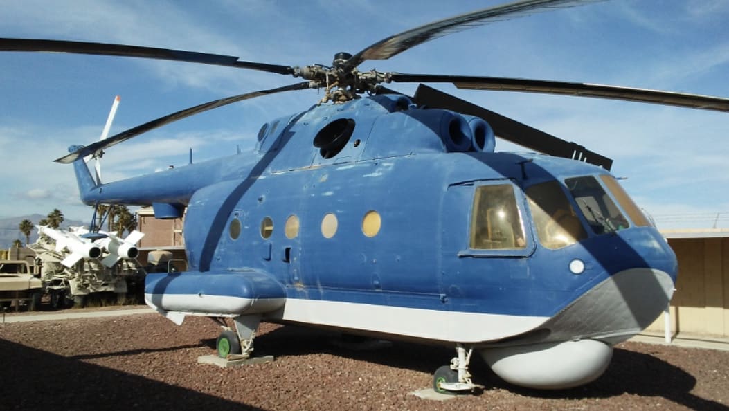
Once I heard about the ability to enter the ‘New & Improved’ Petting Zoo, I couldn’t wait. While in Las Vegas for SHOT, I made plans for my colleagues and me, to visit the ‘Zoo’.

Let me say this: It does NOT disappoint. The Cliffs-Notes are this: There is more shit in there, than a Corsicana Texas Fruitcake. All small arms and weapons from the former Soviet Union and Warsaw Pact relatives, are there. Additionally, there are crew-served weapons, and light and heavy artillery. Moving on, there’s armored personnel carriers and tanks. Since the aviators from all branches will be moving through what’s known as ‘Denied Territory’, there’s a very real possibility they will encounter Surface-to-Air Missiles (SAMs). For visual recognition, the Zoo delivers. All possible types of shoulder-fired missiles, and ground radar systems are present. Every type of Surface-to-Air radar-guided missile system is also there.
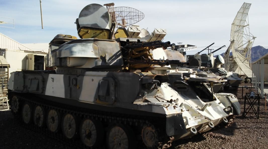
Holy Hannah, does it get any better than this? -Oh yeah. Like the man on the commercial said, “But Wait! There’s MORE!” Fixed- wing aircraft, from a MIG-15, all the way up to a MIG-29! Rotary-wing aircraft, include not only the smaller utility helicopters, but the big, honkin’ HIND-24 Russian Attack Helicopter. In Texas parlance, It’s a big sonafabitch. I can imagine it struck fear into the hearts of the Afghan tribesmen when those huge things came roaring over the mountains. -Right up until the time the mujahedeen got their hands, on U.S. Stinger missiles…. Gotta love technology.
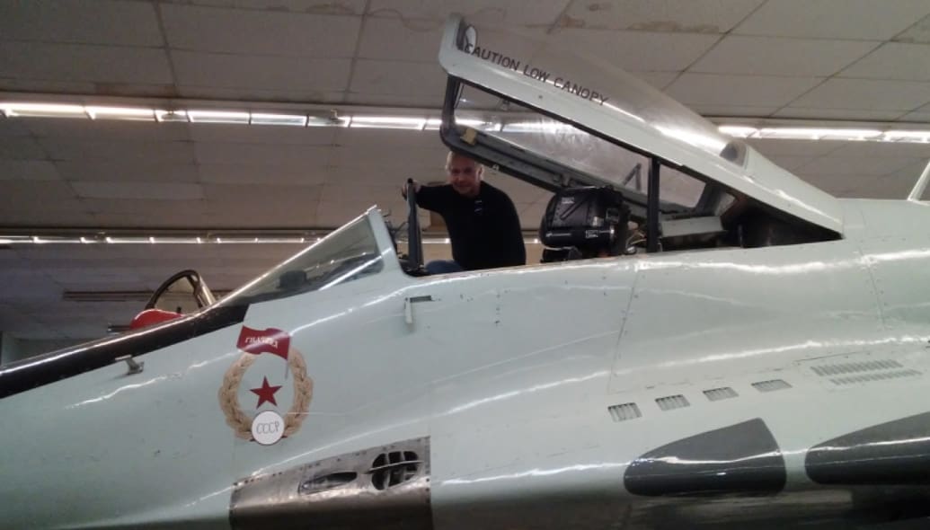
As a former member of Air Force Special Operations, I knew ‘The Back-Story being the Real Story’, and I had to ask where all these artifacts had come from. Some of the articles were ‘gifted’ from defectors, as part of their ‘Desperately Seeking Asylum’ deal. Others came from our allies, as they swept thru their adversary’s armies and air forces. Some of them were what’s known as ‘Battlefield Pick-Up’; sorta like Pick-Up Sticks, only with weapons and stuff. -And others were rumored to be outright stolen by some of the ‘Alphabet Kids’, in their missions to acquire the bad guys goodies. Looking out in the five-plus acre lot that just houses the larger aircraft and missiles, I couldn’t help but wonder what stories these things could tell, if they could talk.
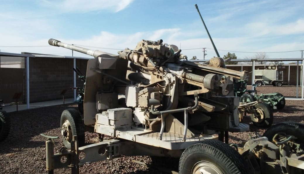
Finally, in closing, I will offer this: I have been told there is a base out in the ‘upper reaches’ of the Nevada Test Range, where MIG-21s, 23s, and 29s reside, and are flown by U.S. Aggressor squadron pilots, to train our U.S. military pilots, on tactics and capabilities. 

Lies? Cock-and-Bull story? Like the poster says: “The Truth Is Out There.’ 

-But since you can’t get there, I urge you to go visit ‘The Petting Zoo’, at Nellis AFB.

V,

SENDS

About the author:

MSgt Steve Venski spent 20 years in the United States Air Force, working in the Avionic Sensors career field.

The Avionic Sensors career field, began the early years of what is now called ISR; Intelligence, Surveillance, and Reconnaissance.

MSgt Venski’s ‘platform resume’ consists of F-4 PHANTOM aircraft, to include both photographic film and electronic reconnaissance. Additionally, laser-target designators, and strike systems.

No career could be complete without serving in Special Operations, of which MSgt Venski did two tours in Southeast Asia, with the AC-130 SPECTRE aircraft.

Upon being some of the last people out of Southeast Asia in 1975, he rotated back to Florida with the 1st Special Operations Wing, out of Hurlburt Field, and enjoyed touring the globe, and introducing bad guys everywhere, to the AC-130 SPECTRE Gunship.

He currently resides in Texas, with his wife and Low-Light Level attack kittens.

“The Meek May Inherit The Earth,

-But The BOLD Shall Command The Skies.”

Admiral Inman’s Rules

Thursday, January 9th, 2020

Bobby Ray Inman is a retired Navy Admiral. An Officer Candidate School graduate and the first Naval Intelligence Officer to earn four stars as a Flag Officer. During the 1970s and into the early 80s, ADM Inman served as Director of Naval Intelligence, Vice Director of the Defense Intelligence Agency, Director of the National Security Agency and Deputy Director of Central Intelligence. Interestingly, he held these last two posts simultaneously for a period, pushing the two agencies to work more closely. He did this by sending memos back and forth to himself, approving them as he went along.

In response to the Beirut bombings of the US Embassy and Marine Barracks, ADM Inman chaired a commission on improving security at U.S. foreign installations.

Some SSD readers may know him for sitting in the Board of Directors of Academi, a corporation formerly known as Blackwater.

His list of rules are well known within the Intelligence Community and may seem at first glance only suited for senior officers working in Washington. While some are specific to that unique arena, many should be implemented immediately upon starting a career and consistently throughout.

1. Conservation of enemies.

2. When you are explaining you are losing.

3. Something too good to believe probably is just that, untrue.

4. Go to the Hill alone.

5. Wisdom in Washington is having much to say and knowing when not to say it.

6. Never sign for anything.

7. The only one looking out for you is you.

8. If you think your enemy is stupid, think again.

9. Never try to fool yourself.

10. Never go into a meeting without knowing what the outcome is going to be.

11. Don’t change what got you to where you are just to get to the next place.

12. Intelligence is knowing what the enemy doesn’t want you to know.

13. Nothing changes faster than yesterday’s vision of the future.

14. Intelligence users are looking for what is going to happen, not what has already occurred.

15. It is much harder to convince someone they are wrong than it is to convince them they are right.

16. For Intelligence Officers in particular there is no substitute for the truth.

17. By the time intelligence gets back to a user with the answer the question usually has changed.

18. Always know your blind spots, get help to cover them.

19. The first report is usually wrong, act but understand more is to come and it will be different.

20. You can never know too much about the enemy.

21. Tell what you know, tell what you don’t know, tell what it means.

22. Tell them what you are going to say, tell them, then tell them what you told them, they might remember something.

23. Never have more than three points.

24. Never follow lunch or an animal act.

25. Believe is correct, intelligence officers never feel.

26. The absence of evidence is not evidence of absence.

27. Boredom is the enemy, not the time to any briefing.

28. If you can’t summarize it on one page, your can’t sell it to anyone.

29. Always allow time to consider what the enemy wants me to think, is he succeeding or am I?

30. If you can’t add value, get out of the way.

SOFWERX – 3D Geospatial Tech Sprint Series

Friday, December 27th, 2019

On 24-28 February, SOFWERX, in concert with USSOCOM Program Executive Office for Special Reconnaissance, Surveillance and Exploitation (PEO-SRSE), will host a 3D Geospatial Tech Sprint to further automate production and dissemination of 3D geospatial data.

Selected software engineers and developers will be afforded the opportunity to collaborate with others to combine their tools for assessment and integration during the week-long event. Selectees will receive an $8,000 stipend for participation in the Tech Sprint.


Submit your technology for review, related to the technology focus areas, to be considered for attendance.

Submit NLT 27 January 11:59 PM EST

For full details, visit www.sofwerx.org/3dgeo

TacJobs – The Ranger MI Bn

Thursday, November 14th, 2019

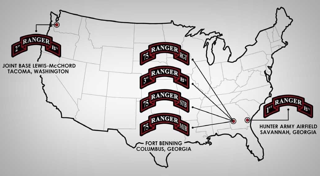
In addition to Military Intelligence in each of the Ranger Battalions and Regimental headquarters, the 75th has a dedicated Military Intelligence Battalion at Fort Benning.

US Army Develops TITAN System To Tie ‘Deep Sensing’ To Long-Range Fires

Tuesday, October 29th, 2019

WASHINGTON — The Army plans to use one of the largest exercises in Europe since the Cold War to pilot new tactical space technology that will help Soldiers carry out mission command on a multi-domain battlefield.

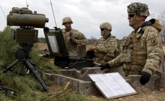
An initial prototype of TITAN — Tactical Intelligence Targeting Access Node — will be tested during the Defender-Europe 20 exercise next spring. The exercise is set to have about 37,000 U.S. and European troops training in 10 nations across the continent.

The TITAN system, which is a scalable and expeditionary intelligence ground station, leverages space and high altitude, aerial, and terrestrial layer sensors to provide targetable data to fires networks. It also provides multi-discipline intelligence support to targeting, and situational awareness and understanding for mission command.

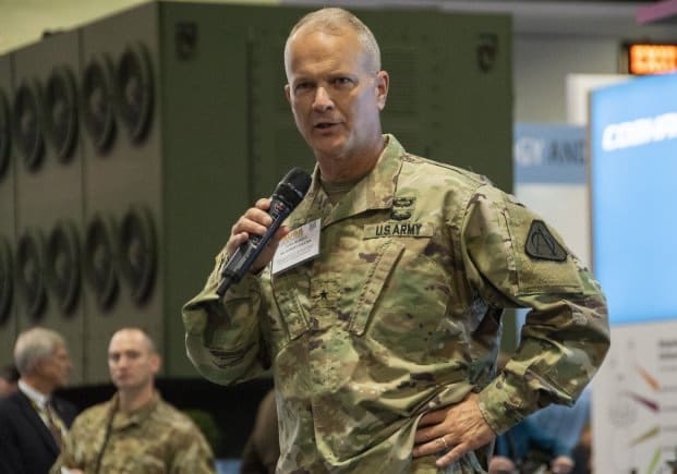
Today, the Army has roughly 100 tactical ground stations, 13 operational ground stations and a few other dissemination vehicles to inform battlefield commanders, said Brig. Gen. Rob Collins, Program Executive Officer for Intelligence, Electronic Warfare and Sensors, or PEO IEW&S.

But “some of those are more specific to the echelon,” he said Oct. 16 at the Association of the U.S. Army Annual Meeting and Exposition. “They’re not necessarily tailorable, easy to use or expeditionary as we want them to be.”

TITAN aims to consolidate much of those capabilities to better provide “deep sensing” information from intelligence, surveillance and reconnaissance sensors from all domains.

It also ties deep sensing to long-range precision strike options to defeat enemy anti-access/aerial denial environments, officials said.

An industry day is scheduled for Dec. 4 at Aberdeen Proving Ground, Maryland, to further discuss the way forward with TITAN.

A TITAN space prototype is expected to be delivered by early fiscal year 2022.

“How do you bring those ground stations together in one platform, or a series of platforms, that are modular, scalable and [with] open systems architecture,” said Willie Nelson, director of Army Futures Command’s Assured Positioning, Navigation and Timing Cross-Functional Team.

Collins said they are looking for a modular “Lego approach” for the system that will go through an iterative testing process, starting with the Defender exercise.

It is then expected to be rolled out in another exercise in the Pacific region to get additional user feedback later next year, Nelson said.

TITAN will fit into the Army’s Multi-Domain Task Forces being built up in the Pacific and in Europe. The system will work with the task force’s unit called I2CEWS, which stands for intelligence, information, cyber, electronic warfare and space.

It will “absolutely be part of that task force to be able to see deep and target deep,” Collins said. “It’s going to be a key capability, key enabler.”

TITAN will also play a large role in the Army’s space strategy, in which one of its main areas is battle management command and control.

“It’s leveraging both commercial and military capabilities to be able to provide eyes and ears on the battlefield for our Soldiers and our platforms,” Nelson said.

Since the sensors will compile massive amounts of data, TITAN will need to rely on artificial intelligence and machine learning to sift through it.

“As we start pulling in all this data, there’s going to be a significant and overwhelming amount for our intelligence Soldiers to be able to process,” Collins said.

The goal will then be to quickly deliver easily-digestible data to Soldiers in combat and to their systems.

“We just don’t collect this data for the sake of collecting it,” Collins said. “We collect it so that we can distribute that to kinetic, non-kinetic weapon systems and for commanders to be able to make decisions on the battlefield.”

By Sean Kimmons, Army News Service

Remote Sensing Network Will Advance Safety and Security Applications in the Arctic

Friday, October 25th, 2019

Copenhagen, Denmark, October 22, 2019 – A new consortium of international companies, called IRSA Development Group (IDG), was announced October 1, 2019, at DEFSEC Atlantic in Halifax, Canada. IDG consists of international companies with expertise in selected technology domains to bring the world an advanced remote sensing network.

Integrated Remote Sensing for the Arctic (IRSA) is a scalable, civilian, all-domain system-of- systems remote sensing solution designed to provide more persistent monitoring of the Arctic. The network comprises satellites, high altitude long endurance (HALE) drones, medium altitude long endurance (MALE) drones, small unmanned aerial systems (sUAS), sea-surface and sub-sea platforms, and ground stations. Technology development for each segment, and their integration, is underway. Initial IRSA services are expected to be available to clients in early 2020.

“We are excited to be part of the IDG collaboration and the development of IRSA. The potential benefits of the IRSA system range from enhancing safety and security applications to supporting Northerners in their response to climate change. The agile team is made up of international leaders in their respective technology areas,” says Paul Adlakha, Managing Director of LOOKNorth at C-CORE.

Recognizing the need for more persistent remote sensing, robust communication and data connectivity in the Arctic, Boeing Defense, Space, and Security (BDS) began an intensive study in 2015, mapping the challenges and identifying gaps in designing and creating a solution to address them. Since then, Boeing has invested in establishing an international consortium to develop the technologies, products and services that can provide that solution through the IRSA program.

“This project is another testament to the reputation of Boeing’s industrial programs and the path for future growth it can provide our partners,” says Maria Laine, Vice President, Boeing International Strategic Partnerships. “Projects like this underscore our commitment to provide opportunities for innovation and technology collaboration around the globe to develop advanced capabilities.”

www.idg.network/tour

Trillium Engineering

Friday, October 11th, 2019

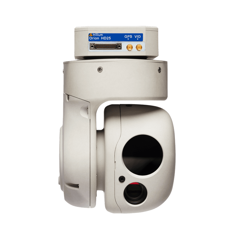
Trillium Engineering was founded in Hood River, Oregon, in 2013 by three engineers with experience in EO/IR sensor development, up to 8″ in size.

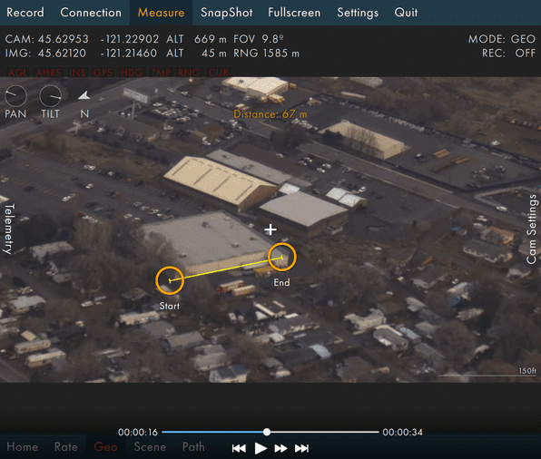
They are vertically integrated, with both in-house development and production. They specialize in stabilization control and GPS INS, integrating highly accurate geopointing along with h.264 video encoding. While the H.264 encoding standard might blur imagery, the newer H.265 is a more efficient compression. For instance, you’ll see 20-50 MBs with WiFi and .5-1 MBs for UAS operation.

I am particularly impressed with the HD25-XV, which is an EO only configuration, integrating a 3.5x optical zoom visible camera. Now get this, it’s a gimbaled camera weighing just 325g.

Much of their work is directly with OEM UAS producers. For example, the Trillium HD-45 sensor has already been integrated on the Lockheed-Martin Stalker.

However, Trillium can also provide sensors as upgraded payloads for already fielded platforms. In this case, they prefer whenever possible, to work directly with the customer in order to engineer a proper installation. Considering their sensor payload weights and sizes, there may be additional room for extra batteries, or an additional sensor.

To be sure, Trillium’s gimbaled EO/IR sensors are fantastic, but they combine them with intuitive software. They offer a 3D map GUI called Skylink which will run on Samsung tablets and handhelds. It allows control of the gimbal. Additionally, their feed is MISB compliant and will interface with ATAK.

To learn more, visit trilliumeng.com.