GoTAK is proud to highlight a recent operational deployment delivered in partnership with Solace Communications, bringing a full TAK OS enabled C4ISR capability and mission-focused training to an allied partner force in Central Africa.
This deployment demonstrates how TAK OS, when paired with resilient communications, integrated sensors, and operator-led training, transitions from a platform into a field-proven operational capability—supporting situational awareness and mission execution under real-world conditions.
Fielding TAK OS in Operational Environments
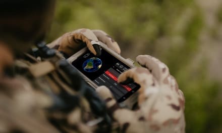
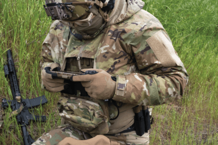
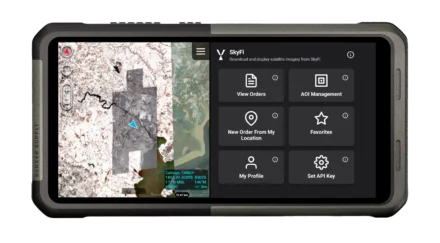
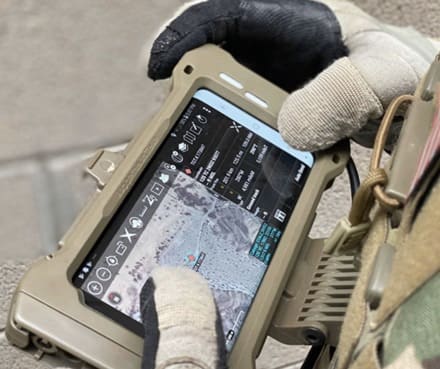
Over the course of recent deployments, Solace Communications successfully fielded an integrated C4ISR stack built around TAK OS, delivering a common operating picture directly to operators and commanders in the field. The capability included:
- Cloud-hosted and local TAK OS environments
- Resilient connectivity via GlobalLink
- Live UAS ISR feeds delivered directly to operators’ EUDs
- Edge-based AI object detection and sensor integration
- A fused, real-time intelligence picture via Solace Fusion
From the GoTAK perspective, this deployment reflects the intended design philosophy of TAK OS: a networked operational layer that connects sensors, operators, and decision-makers across multiple transport paths and environments.
Proven Capability, Moving Toward TRL 9
The system operated as a fully integrated capability under field conditions, supporting sustained situational awareness and mission execution. As a result, Solace Communications has demonstrated TRL 8 across this integrated architecture, with planned upgrades already underway to advance toward TRL 9 through continued operational use.
These upgrades include transitioning deployed GlobalLink units to the Pro configuration, adding:
- Local server hosting and off-grid power
- Local TAK OS hosting for disconnected operations
- LTE and SATCOM failover connectivity
- Direct integration with MANET radios
This architecture reduces latency, removes dependence on backhaul connectivity, and enables sustained operations in disconnected, denied, and degraded environments.
Training That Enables Sustained Operations
Alongside capability delivery, Solace Communications provided end-to-end TAK OS and MANET training, deliberately structured to move beyond basic familiarization. Training tiers included:
- Foundational instruction for operators new to TAK OS and MANET
- Advanced configuration and network management for technical staff
- Train-the-trainer modules to support independent sustainment and scale
This approach ensures TAK OS is not just deployed, but understood, trusted, and operationally owned by the teams using it.
A Shared Vision for Operational TAK
This Central Africa deployment highlights the strength of the partnership between GoTAK and Solace Communications. When TAK OS is combined with resilient transport, edge processing, and real-world training, it becomes a force multiplier—extending situational awareness at the edge and beyond, across time, distance, and connectivity constraints.
From integrated ISR feeds to fused intelligence and resilient communications, this deployment underscores what can be achieved when TAK capabilities are delivered by teams who understand operational reality.
GoTAK looks forward to continuing our collaboration with Solace Communications as TAK OS capabilities expand into new environments and mission sets.